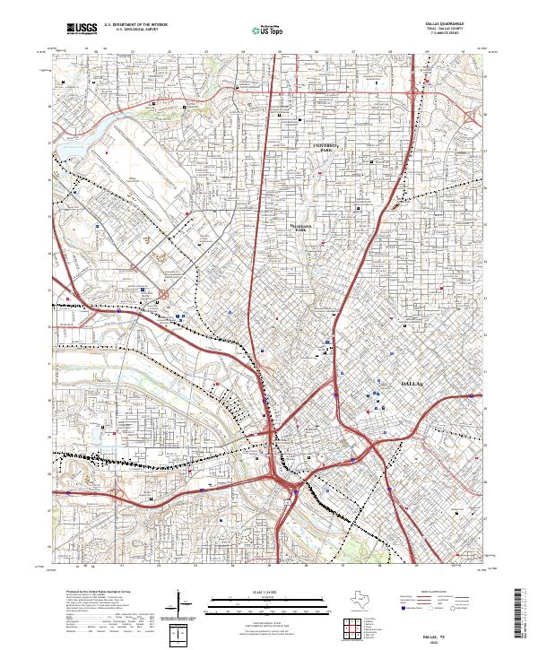
2022 Map of Dallas
USGS Topo · Published 2022About this map
Dallas and its immediate enclaves of University Park and Highland Park are defined here by a dense urban grid constrained by the wandering course of the Trinity River. The map documents a significant concentration of columbaria and memorial sites, including the Lovers Lane United Methodist Church Columbarium and Saint Matthews Episcopal Cathedral Columbarium, reflecting the area's established ecclesiastical history. Academic and civic anchors are prominent, from Southern Methodist University in the north to the George L Allen Sr Courts Building downtown.
Find a feature on this map
47 named features on this map. Tap any name to fly to it.
Don’t see what you’re looking for? This feature index may not catch every label — zoom into the map to look around manually.
Map Details
Editions of this 2022 Dallas Map
This is the sole edition of this map. No revisions or reprints were ever made.
Other maps of this area

1891 · Dallas
USGS Topo · 1:125,000

1893 · Dallas
USGS Topo · 1:125,000

1925 · Dallas 2-b
USGS Topo · 1:48,000

1931 · Carrollton
USGS Topo · 1:62,500

1954 · Dallas
USGS Topo · 1:250,000

1957 · White Rock Lake
USGS Topo · 1:24,000

1958 · Dallas
USGS Topo · 1:250,000

1958 · Hutchins
USGS Topo · 1:24,000

1958 · Oak Cliff
USGS Topo · 1:24,000

1958 · Dallas
USGS Topo · 1:24,000