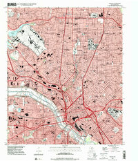
1995 Map of Dallas
USGS Topo · Published 2001About this map
Dallas Love Field dominates the northwest quadrant of this 1995 landscape, serving as a primary hub for an urban core that balances massive aviation and medical infrastructure with historic residential enclaves. The central business district is anchored by City Hall and the Union Sta Convention Center, while the Southwestern Medical Center and Parkland Hospital form a dense institutional corridor. The Trinity River and the Dallas Floodway define the southwestern edge of the downtown area, creating a distinct environmental boundary against the grid of the city. To the north, the incorporated enclaves of University Park and Highland Park are clearly delineated, centered around Southern Methodist University. Notable historic landmarks including the Cotton Bowl at the edge of the fairgrounds and established burial sites like Greenwood Cem and Oakland Cem offer significant points of interest for local history and genealogy research.
Find a feature on this map
122 named features on this map. Tap any name to fly to it.
Don’t see what you’re looking for? This feature index may not catch every label — zoom into the map to look around manually.
Map Details
Editions of this 1995 Dallas Map
This is the sole edition of this map. No revisions or reprints were ever made.
Other maps of this area

1891 · Dallas
USGS Topo · 1:125,000

1893 · Dallas
USGS Topo · 1:125,000

1925 · Dallas 2-b
USGS Topo · 1:48,000

1931 · Carrollton
USGS Topo · 1:62,500

1954 · Dallas
USGS Topo · 1:250,000

1957 · White Rock Lake
USGS Topo · 1:24,000

1958 · Dallas
USGS Topo · 1:250,000

1958 · Hutchins
USGS Topo · 1:24,000

1958 · Oak Cliff
USGS Topo · 1:24,000

1958 · Dallas
USGS Topo · 1:24,000