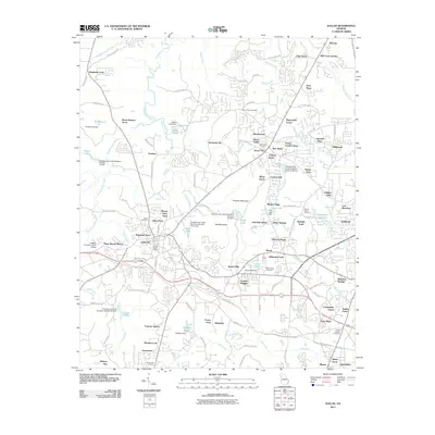
2011 Map of Dallas
USGS Topo · Published 2011About this map
Dallas serves as the focal point of this Paulding County survey, illustrating the convergence of suburban expansion and rural heritage. The town's historical foundations are visible through the Dallas Post Office and Dallas Cemetery, while the surrounding landscape is marked by numerous family-named landmarks and historical burial grounds such as Mount Zion Cemetery and New Hope Cemetery. The topography is defined by the significant corridor of Pumpkinvine Creek, which features a series of flood control structures and dams including Pumpkinvine Creek Structure Number 67 Dam and Pumpkinvine Creek Structure Number 50 Dam. These engineering efforts transformed the local hydrology, creating water bodies like Braly Lake and Cole Lake. To the east, the terrain rises toward Elsberry Mountain and Ray Mountain, framing a region where modern developments like Westward Ho and Twelve Oaks sit alongside older settlements.
Find a feature on this map
134 named features on this map. Tap any name to fly to it.
Don’t see what you’re looking for? This feature index may not catch every label — zoom into the map to look around manually.
Map Details
Editions of this 2011 Dallas Map
This is the sole edition of this map. No revisions or reprints were ever made.
Other maps of this area

1890 · Cartersville
USGS Topo · 1:125,000

1891 · Marietta
USGS Topo · 1:125,000

1891 · Cartersville
USGS Topo · 1:125,000

1895 · Marietta
USGS Topo · 1:125,000

1896 · Cartersville
USGS Topo · 1:125,000

1897 · Marietta
USGS Topo · 1:125,000

1901 · Marietta
USGS Topo · 1:125,000

1906 · Stilesboro
USGS Topo · 1:62,500

1907 · Acworth
USGS Topo · 1:62,500

1908 · Stilesboro
USGS Topo · 1:62,500