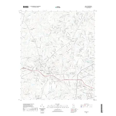
2020 Map of Dallas
USGS Topo · Published 2020About this map
The Paulding County Courthouse serves as the focal point for Dallas, where the modern suburban landscape of Georgia meets its deeper historical roots. This era shows the convergence of traditional transit routes and contemporary recreation, most notably the Silver Comet Side Trail following the old rail corridor through town. The map documents numerous heritage sites essential for local history and genealogy, including Old Shady Grove Cem and Mount Zion Cem. Beyond the city center, the terrain is defined by Elsberry Mtn and Ray Mtn, with a dense network of water bodies such as Pumpkinvine Creek, Dodd Lake, and Cole Lake. The presence of the Chattahoochee Technical College Paulding Campus reflects the modern educational infrastructure supporting the growing communities of Hiram and New Hope.
Find a feature on this map
250 named features on this map. Tap any name to fly to it.
Don’t see what you’re looking for? This feature index may not catch every label — zoom into the map to look around manually.
Map Details
Editions of this 2020 Dallas Map
This is the sole edition of this map. No revisions or reprints were ever made.
Other maps of this area

1890 · Cartersville
USGS Topo · 1:125,000

1891 · Marietta
USGS Topo · 1:125,000

1891 · Cartersville
USGS Topo · 1:125,000

1895 · Marietta
USGS Topo · 1:125,000

1896 · Cartersville
USGS Topo · 1:125,000

1897 · Marietta
USGS Topo · 1:125,000

1901 · Marietta
USGS Topo · 1:125,000

1906 · Stilesboro
USGS Topo · 1:62,500

1907 · Acworth
USGS Topo · 1:62,500

1908 · Stilesboro
USGS Topo · 1:62,500