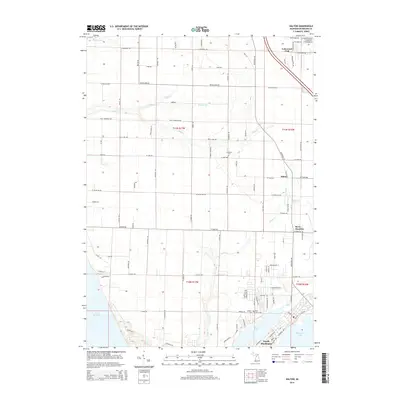
2014 Map of Dalton
USGS Topo · Published 2014About this map
Lakewood Club and Dalton serve as primary anchors in this coastal Michigan landscape, situated just north of the busy waterways of North Muskegon. The terrain is defined by a dense network of tributaries including Duck Cr, Scholes Cr, and Green Cr, which flow toward the eastern shore of Lake Michigan. This 2014 survey reveals a transition from the structured residential blocks near Muskegon Lake to the more dispersed rural parcels of the interior. Genealogists can identify several historic burial sites, such as Fruitland Cem, Laketon Cem, and Bear Lake Cem, which are tucked away along local routes like W Bard RD and Fenner RD. The presence of Berry Junction further inland highlights the historical intersection of transportation lines that once shaped the growth of Muskegon County, while the preserved shoreline of Bear Lake remains a prominent geographic feature.
Find a feature on this map
42 named features on this map. Tap any name to fly to it.
Don’t see what you’re looking for? This feature index may not catch every label — zoom into the map to look around manually.
Map Details
Editions of this 2014 Dalton Map
This is the sole edition of this map. No revisions or reprints were ever made.
Other maps of this area

1929 · Montague
USGS Topo · 1:48,000

1930 · Lake Harbor
USGS Topo · 1:48,000

1930 · Muskegon
USGS Topo · 1:62,500

1936 · Muskegon
USGS Topo · 1:62,500

1936 · Lake Harbor
USGS Topo · 1:62,500

1954 · Milwaukee
USGS Topo · 1:250,000

1958 · Milwaukee
USGS Topo · 1:250,000

1958 · Twin Lake
USGS Topo · 1:62,500

1959 · Montague
USGS Topo · 1:62,500
1972 · Muskegon West
USGS Topo · 1:24,000