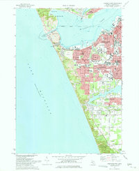
1972 Map of Muskegon West
USGS Topo · Published 1975About this map
The industrial and maritime core of Muskegon and Muskegon Heights is shown here during the early 1970s, revealing a landscape defined by its proximity to Lake Michigan. Rail networks including the Chesapeake and Ohio RR and Grand Trunk Western RR serve the heavy industrial zones near the waterfront, while the residential expansion of Roosevelt Park and Norton Shores pushes inland. The map details a sophisticated coastal infrastructure ranging from the Naval Reserve Station and Coast Guard Sta near the entrance to Lake Muskegon to the southern Muskegon County Airport. Large recreational and preservation areas like P J Hoffmaster State Park and Muskegon State Park anchor the shoreline, protecting high coastal dunes like Pigeon Hill and natural landmarks such as Devils Kitchen.
Find a feature on this map
93 named features on this map. Tap any name to fly to it.
Don’t see what you’re looking for? This feature index may not catch every label — zoom into the map to look around manually.
Map Details
Editions of this 1972 Muskegon West Map
2 editions found
Other maps of this area

1929 · Montague
USGS Topo · 1:48,000

1930 · Lake Harbor
USGS Topo · 1:48,000

1930 · Muskegon
USGS Topo · 1:62,500

1936 · Muskegon
USGS Topo · 1:62,500

1936 · Lake Harbor
USGS Topo · 1:62,500

1954 · Milwaukee
USGS Topo · 1:250,000

1958 · Milwaukee
USGS Topo · 1:250,000

1958 · Twin Lake
USGS Topo · 1:62,500

1959 · Montague
USGS Topo · 1:62,500
1972 · Grand Haven
USGS Topo · 1:24,000