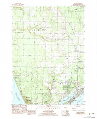
1983 Map of Dalton
USGS Topo · Published 1983About this map
Fruitland and Laketon townships meet the shore of Lake Michigan in this early 1980s study of the Muskegon area. The landscape is defined by the transition from rural woodlands to the growing residential fringes of North Muskegon. Along the shoreline, Muskegon State Park and Pioneer County Park preserve the lakefront, while inland, smaller settlements like Lakewood Club and Michillinda are connected by a network of local roads such as Whitehall Road.
Find a feature on this map
71 named features on this map. Tap any name to fly to it.
Don’t see what you’re looking for? This feature index may not catch every label — zoom into the map to look around manually.
Map Details
Editions of this 1983 Dalton Map
This is the sole edition of this map. No revisions or reprints were ever made.
Other maps of this area

1929 · Montague
USGS Topo · 1:48,000

1930 · Lake Harbor
USGS Topo · 1:48,000

1930 · Muskegon
USGS Topo · 1:62,500

1936 · Muskegon
USGS Topo · 1:62,500

1936 · Lake Harbor
USGS Topo · 1:62,500

1954 · Milwaukee
USGS Topo · 1:250,000

1958 · Milwaukee
USGS Topo · 1:250,000

1958 · Twin Lake
USGS Topo · 1:62,500

1959 · Montague
USGS Topo · 1:62,500
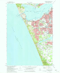
1972 · Muskegon West
USGS Topo · 1:24,000
Featured Places
- Muskegon, MI
- Dalton, Dalton Township
- North Muskegon, MI
- Lakewood Club, Dalton Township
- Laketon Township, MI