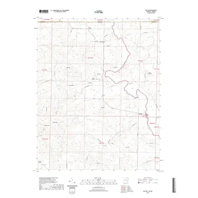
2020 Map of Dalton
USGS Topo · Published 2020About this map
Eleven Point River winds through this landscape on the Missouri-Arkansas border, serving as the central geographic feature of the region. The small settlement of Dalton sits near the river's bend in the southeast, while Elm Store marks a point of interest further north toward the state line. This rural area in Randolph County is characterized by its numerous small drainage systems, such as Bakers Creek and Diles Creek, which have carved out hollows including Dubois Hollow and Bartley Hollow.
Find a feature on this map
66 named features on this map. Tap any name to fly to it.
Don’t see what you’re looking for? This feature index may not catch every label — zoom into the map to look around manually.
Map Details
Editions of this 2020 Dalton Map
This is the sole edition of this map. No revisions or reprints were ever made.
Other maps of this area

1941 · Gatewood
USGS Topo · 1:62,500

1944 · Couch
USGS Topo · 1:62,500

1945 · Gatewood
USGS Topo · 1:62,500

1946 · Couch
USGS Topo · 1:62,500

1957 · Poplar Bluff
USGS Topo · 1:250,000

1959 · Poplar Bluff
USGS Topo · 1:250,000

1960 · Poplar Bluff
USGS Topo · 1:250,000

1965 · Gatewood
USGS Topo · 1:24,000

1966 · Ravenden Springs
USGS Topo · 1:24,000
1966 · Ravenden Springs SE
USGS Topo · 1:24,000