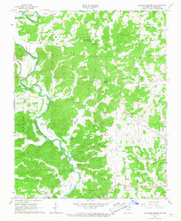
1966 Map of Ravenden Springs SE
USGS Topo · Published 1967About this map
The Eleven Point River dominates this mid-1960s landscape, winding through a series of townships including Eleven Points, Shiloh, and Roanoke. The river corridor is marked by the Black Ferry Bridge and a Gaging Station, reflecting a landscape defined by its waterways. Small settlements and crossroads like Powell and Knotts are visible, while the map provides significant detail for family historians with numerous small burial grounds and rural meeting places. Specifically, McIlroy Cem, Ross Cem, and Thomas Cem are noted near the ridges and creek beds. Religious and community life is centered at Gravesville Ch and Old Union Ch. The terrain transitions from the river bottomlands up to local heights such as Cooley Hill, with natural springs like Coldwater Spring and Fivemile Spring surfacing across the wooded hillsides.
Find a feature on this map
43 named features on this map. Tap any name to fly to it.
Don’t see what you’re looking for? This feature index may not catch every label — zoom into the map to look around manually.
Map Details
Editions of this 1966 Ravenden Springs SE Map
2 editions found
Other maps of this area

1932 · Walnut Ridge
USGS Topo · 1:62,500

1934 · Powhatan
USGS Topo · 1:62,500

1935 · Powhatan
USGS Topo · 1:62,500

1935 · Reyno
USGS Topo · 1:62,500

1935 · Walnut Ridge
USGS Topo · 1:62,500

1957 · Poplar Bluff
USGS Topo · 1:250,000

1959 · Poplar Bluff
USGS Topo · 1:250,000

1960 · Poplar Bluff
USGS Topo · 1:250,000
1965 · Manson
USGS Topo · 1:24,000

1966 · Ravenden Springs
USGS Topo · 1:24,000