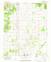
1965 Map of Manson
USGS Topo · Published 1966About this map
Black River meanders through the western portion of this 1960s survey, creating a complex geography of oxbows and landings such as Dishpan Lake, Horseshoe Lake, and Hoover Landing. The landscape is defined by the transition between these river lowlands and the higher ground of Wiley Oak Ridge to the east. Transportation infrastructure is prominent, with the St Louis-San Francisco railroad line running north-south, passing through the settlements of Shannon, Manson, and Elnora.
Find a feature on this map
45 named features on this map. Tap any name to fly to it.
Don’t see what you’re looking for? This feature index may not catch every label — zoom into the map to look around manually.
Map Details
Editions of this 1965 Manson Map
This is the sole edition of this map. No revisions or reprints were ever made.
Other maps of this area

1932 · Walnut Ridge
USGS Topo · 1:62,500

1934 · Powhatan
USGS Topo · 1:62,500

1935 · Powhatan
USGS Topo · 1:62,500

1935 · Reyno
USGS Topo · 1:62,500

1935 · Walnut Ridge
USGS Topo · 1:62,500

1957 · Poplar Bluff
USGS Topo · 1:250,000

1959 · Poplar Bluff
USGS Topo · 1:250,000

1960 · Poplar Bluff
USGS Topo · 1:250,000
1965 · Walnut Ridge SE
USGS Topo · 1:24,000
1965 · O'Kean
USGS Topo · 1:24,000