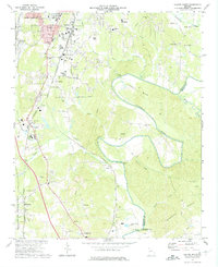
1972 Map of Dalton South
USGS Topo · Published 1974About this map
The Conasauga River carves a striking path through Whitfield County, defined by the sweeping loop of Loopers Bend. This 1970s landscape is a study in transition, where the southern reaches of Dalton meet the rural expanses of the Chattahoochee National Forest. The local economy and community life are anchored by the dual presence of the Southern and Louisville and Nashville railroads, which parallel the river and connect small settlements like Tilton and Carbondale. A network of country churches and schools, such as Fairview Ch and East Brook High Sch, serves as the social fabric for scattered homesteads. Industrial activity is represented by the Industrial Waste Pond near the Gordon County line, while historical agricultural foundations are visible at Keiths Mill on Coahulla Creek. From the heights of Brackett Ridges to the lowlands of Swamp Creek, the map details a region balancing natural topography with burgeoning infrastructure.
Find a feature on this map
53 named features on this map. Tap any name to fly to it.
Don’t see what you’re looking for? This feature index may not catch every label — zoom into the map to look around manually.
Map Details
Editions of this 1972 Dalton South Map
2 editions found
Other maps of this area

1886 · Dalton
USGS Topo · 1:125,000

1886 · Ringgold
USGS Topo · 1:125,000

1892 · Ringgold
USGS Topo · 1:125,000

1892 · Dalton
USGS Topo · 1:125,000

1897 · Dalton
USGS Topo · 1:125,000

1935 · Villanow
USGS Topo · 1:24,000

1935 · Tunnel Hill
USGS Topo · 1:24,000

1938 · Chatsworth
USGS Topo · 1:48,000

1943 · Dalton
USGS Topo · 1:62,500
1943 · Tunnel Hill
USGS Topo · 1:24,000