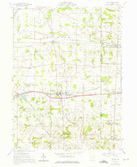
1961 Map of Dalton
USGS Topo · Published 1975About this map
The village of Dalton serves as the central hub of this 1961 survey, situated at the boundary of Wayne and Stark Counties. This rural landscape is defined by its deep religious and educational roots, evidenced by the cluster of landmarks near Kidron such as Sonnenberg School and the Sonnenberg Cemetery. The transportation network reveals a transition in mobility, where the Pennsylvania Railroad and the New York Chicago and St Louis Railroad intersect with emerging local roads like Alabama Avenue. Along Sugar Creek and Newman Creek, the terrain transitions from agricultural fields to industrial operations, including a Strip Mine and a Mine Dump near North Lawrence. Smaller settlements like Burton City and Snively illustrate the late mid-century settlement pattern of eastern Ohio before significant modern expansion altered the character of these farming communities.
Find a feature on this map
49 named features on this map. Tap any name to fly to it.
Don’t see what you’re looking for? This feature index may not catch every label — zoom into the map to look around manually.
Map Details
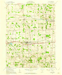
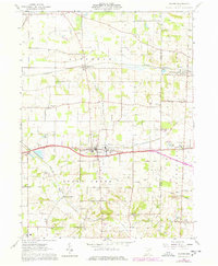
Editions of this 1961 Dalton Map
3 editions found
Other maps of this area

1901 · Massillon
USGS Topo · 1:62,500

1901 · Wooster
USGS Topo · 1:62,500

1903 · Massillon
USGS Topo · 1:62,500

1903 · Wooster
USGS Topo · 1:62,500

1914 · Navarre
USGS Topo · 1:62,500

1915 · Millersburg
USGS Topo · 1:62,500

1943 · Millersburg
USGS Topo · 1:62,500

1944 · Navarre
USGS Topo · 1:62,500

1951 · Canton
USGS Topo · 1:250,000

1953 · Canton
USGS Topo · 1:250,000