
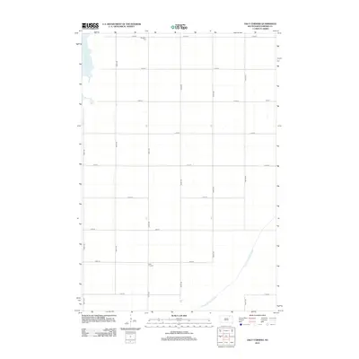
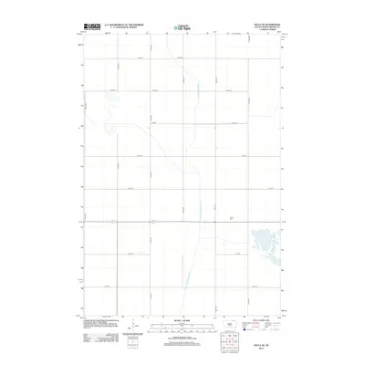
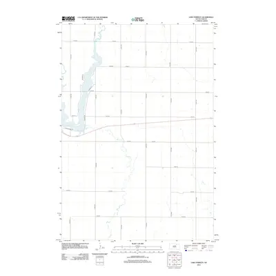
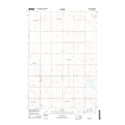
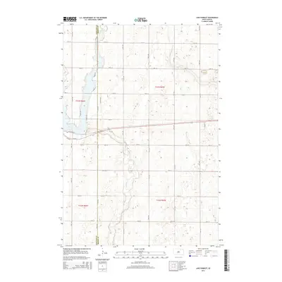
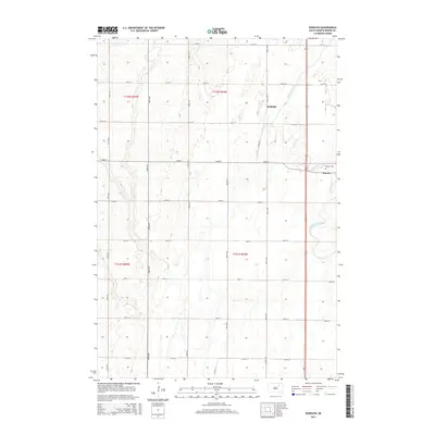
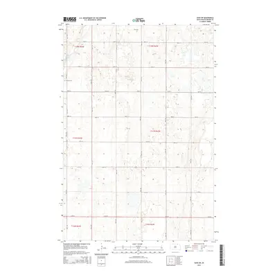
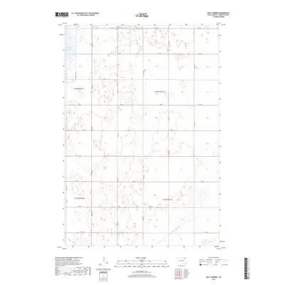
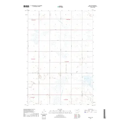
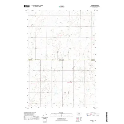
1954 Map of Daly Corners
USGS Topo · Published 1993About this map
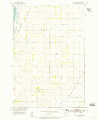
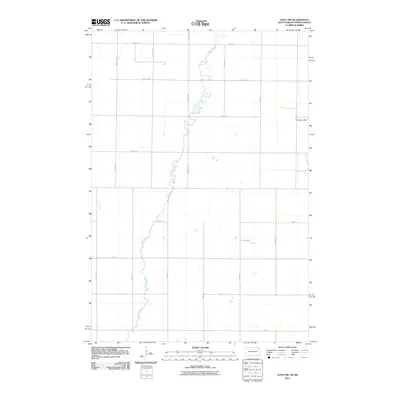
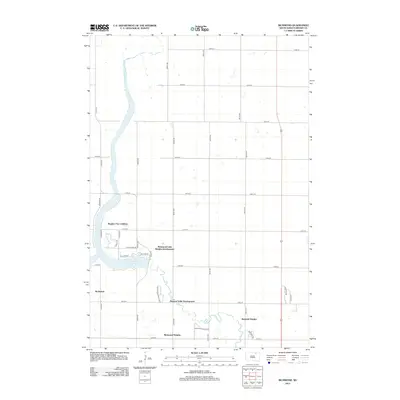
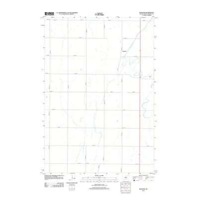
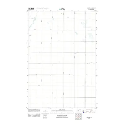
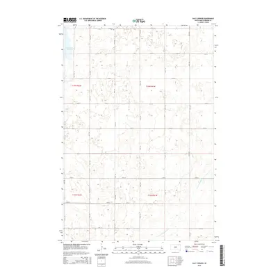
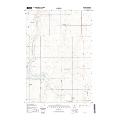
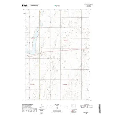
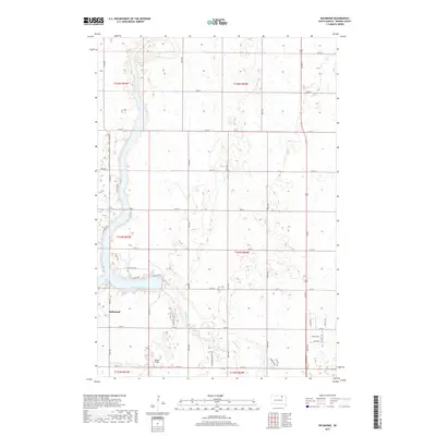
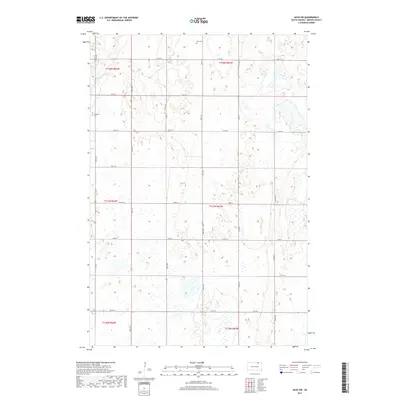
Sand Lake and the National Wildlife Refuge dominate the northwestern corner of this Brown County landscape, where the waters of the Columbia Road Reservoir meet the prairie. The map captures the organized rural structure of Shelby, Columbia, and Claremont townships during the mid-1950s. Settlement patterns are defined by the Chicago and North Western railroad line and small community hubs like Daly Corners. The presence of the Houghton Cem and local schoolhouses such as Knecht Sch and James Sch highlights the distributed nature of social life in this agricultural region. Water management is a visible priority, evidenced by the extensive Crow Creek Drainage Ditch and a specifically noted Flowing Well in the northern fields.
Find a feature on this map
13 named features on this map. Tap any name to fly to it.
Don’t see what you’re looking for? This feature index may not catch every label — zoom into the map to look around manually.
Map Details
Editions of this 1954 Daly Corners Map
3 editions found
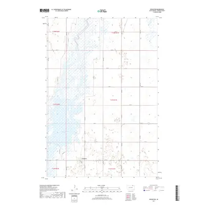
Historical Maps of Shelby Township Through Time
122 maps found

1952 Columbia NE
Brown County, SD

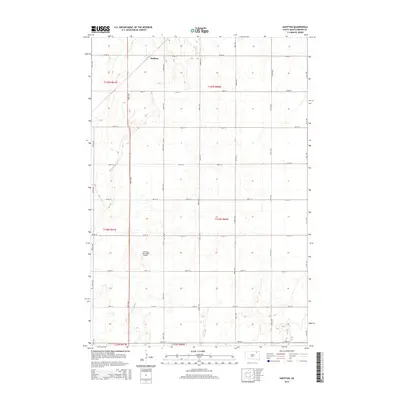
1952 Huffton
Brown County, SD

1952 Ordway
Brown County, SD

1952 Putney
Brown County, SD

1952 Richmond NE
Brown County, SD

1953 Groton SW
Brown County, SD

1953 Hecla SE
Brown County, SD

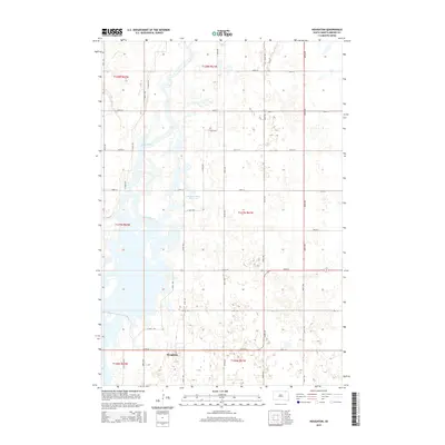
1953 Houghton
Brown County, SD

1953 Savo SE
Brown County, SD

1953 Savo SW
Brown County, SD
1954 Daly Corners
Brown County, SD

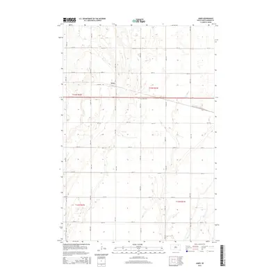
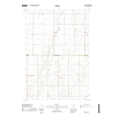
1954 James
Brown County, SD

1960 Aberdeen East
Brown County, SD

1960 Aberdeen West
Brown County, SD

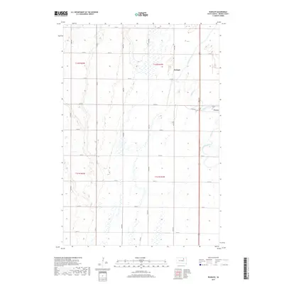
1960 Rudolph
Brown County, SD

1968 Frederick NW
Brown County, SD

1968 Frederick SW
Brown County, SD

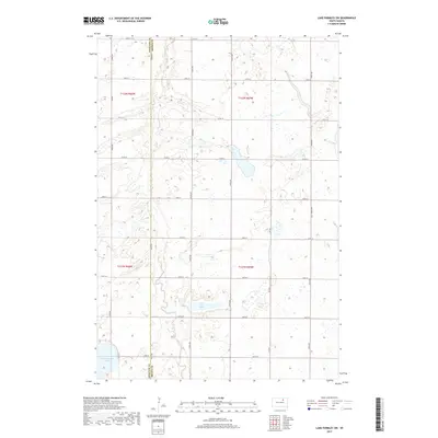
1970 Lake Parmley
Brown County, SD

1970 Lake Parmley SW
Brown County, SD

1970 Richmond
Brown County, SD

1970 Richmond NW
Brown County, SD

1970 Richmond SW
Brown County, SD

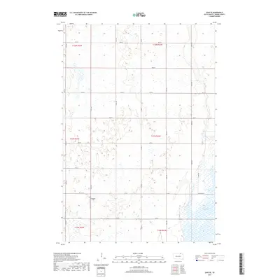
1985 Elm River
Brown County, SD
2011 Frederick NW
Brown County, SD
2011 Savo NE
Brown County, SD
2011 Savo NW
Brown County, SD
2012 Aberdeen East
Brown County, SD
2012 Aberdeen West
Brown County, SD
2012 Columbia NE
Brown County, SD
2012 Daly Corners
Brown County, SD
2012 Frederick NW
Brown County, SD
2012 Frederick SW
Brown County, SD
2012 Groton SW
Brown County, SD
2012 Hecla SE
Brown County, SD
2012 Houghton
Brown County, SD
2012 Huffton
Brown County, SD
2012 James
Brown County, SD
2012 Lake Parmley
Brown County, SD
2012 Lake Parmley SW
Brown County, SD
2012 Ordway
Brown County, SD
2012 Putney
Brown County, SD
2012 Richmond
Brown County, SD
2012 Richmond NE
Brown County, SD
2012 Richmond NW
Brown County, SD
2012 Richmond SW
Brown County, SD
2012 Rudolph
Brown County, SD
2012 Savo NE
Brown County, SD
2012 Savo NW
Brown County, SD
2012 Savo SE
Brown County, SD
2012 Savo SW
Brown County, SD
2015 Aberdeen East
Brown County, SD
2015 Aberdeen West
Brown County, SD
2015 Columbia NE
Brown County, SD
2015 Daly Corners
Brown County, SD
2015 Frederick NW
Brown County, SD
2015 Frederick SW
Brown County, SD
2015 Groton SW
Brown County, SD
2015 Hecla SE
Brown County, SD
2015 Houghton
Brown County, SD
2015 Huffton
Brown County, SD
2015 James
Brown County, SD
2015 Lake Parmley
Brown County, SD
2015 Lake Parmley SW
Brown County, SD
2015 Ordway
Brown County, SD
2015 Putney
Brown County, SD
2015 Richmond
Brown County, SD
2015 Richmond NE
Brown County, SD
2015 Richmond NW
Brown County, SD
2015 Richmond SW
Brown County, SD
2015 Rudolph
Brown County, SD
2015 Savo NE
Brown County, SD
2015 Savo NW
Brown County, SD
2015 Savo SE
Brown County, SD
2015 Savo SW
Brown County, SD
2017 Aberdeen East
Brown County, SD
2017 Aberdeen West
Brown County, SD
2017 Columbia NE
Brown County, SD
2017 Daly Corners
Brown County, SD
2017 Frederick NW
Brown County, SD
2017 Frederick SW
Brown County, SD
2017 Groton SW
Brown County, SD
2017 Hecla SE
Brown County, SD
2017 Houghton
Brown County, SD
2017 Huffton
Brown County, SD
2017 James
Brown County, SD
2017 Lake Parmley
Brown County, SD
2017 Lake Parmley SW
Brown County, SD
2017 Ordway
Brown County, SD
2017 Putney
Brown County, SD
2017 Richmond
Brown County, SD
2017 Richmond NE
Brown County, SD
2017 Richmond NW
Brown County, SD
2017 Richmond SW
Brown County, SD
2017 Rudolph
Brown County, SD
2017 Savo NE
Brown County, SD
2017 Savo NW
Brown County, SD
2017 Savo SE
Brown County, SD
2017 Savo SW
Brown County, SD

2021 Aberdeen East
Brown County, SD

2021 Aberdeen West
Brown County, SD

2021 Columbia NE
Brown County, SD

2021 Daly Corners
Brown County, SD

2021 Frederick NW
Brown County, SD

2021 Frederick SW
Brown County, SD

2021 Groton SW
Brown County, SD

2021 Hecla SE
Brown County, SD

2021 Houghton
Brown County, SD

2021 Huffton
Brown County, SD

2021 James
Brown County, SD

2021 Lake Parmley
Brown County, SD

2021 Lake Parmley SW
Brown County, SD

2021 Ordway
Brown County, SD

2021 Putney
Brown County, SD

2021 Richmond
Brown County, SD

2021 Richmond NE
Brown County, SD

2021 Richmond NW
Brown County, SD

2021 Richmond SW
Brown County, SD

2021 Rudolph
Brown County, SD

2021 Savo NE
Brown County, SD

2021 Savo NW
Brown County, SD

2021 Savo SE
Brown County, SD

2021 Savo SW
Brown County, SD