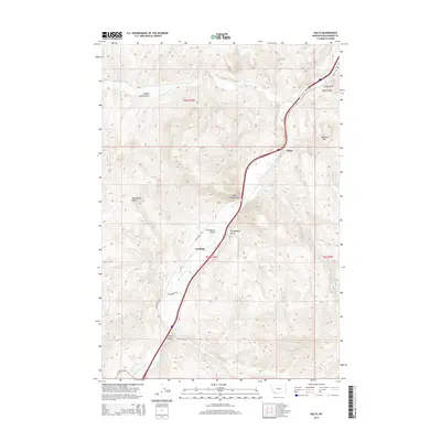
2014 Map of Dalys
USGS Topo · Published 2014About this map
The Beaverhead River carves a central path through this portion of Beaverhead County, creating a corridor of transportation and settlement defined by its winding valley. Historically significant landmarks like Pipe Organ Rock and Henneberry Bridge sit along this waterway, marking the movement of people and goods through the high Montana terrain. Small settlements including Dalys, Grayling, and Clark Canyon are positioned where the valley floor allows for habitation, often near the junctions of seasonal drainage routes.
Find a feature on this map
23 named features on this map. Tap any name to fly to it.
Don’t see what you’re looking for? This feature index may not catch every label — zoom into the map to look around manually.
Map Details
Editions of this 2014 Dalys Map
This is the sole edition of this map. No revisions or reprints were ever made.
Other maps of this area

1893 · Dillon
USGS Topo · 1:250,000

1952 · Bannack
USGS Topo · 1:24,000

1952 · Burns Mountain
USGS Topo · 1:24,000

1952 · Eli Spring
USGS Topo · 1:24,000

1952 · Dalys
USGS Topo · 1:24,000

1952 · Gallagher Mountain
USGS Topo · 1:24,000

1955 · Dubois
USGS Topo · 1:250,000

1955 · Dillon
USGS Topo · 1:250,000

1957 · Dillon
USGS Topo · 1:250,000

1958 · Dubois
USGS Topo · 1:250,000