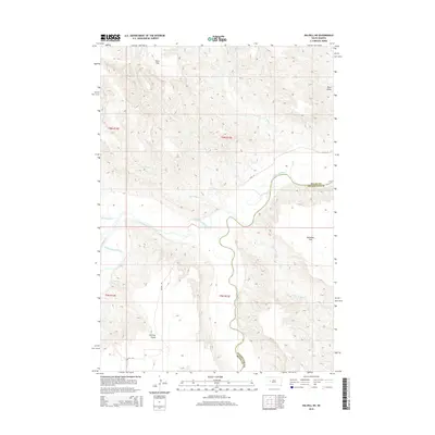
2015 Map of Dalzell NE
USGS Topo · Published 2015About this map
The western edges of Pennington County near the Meade County line are defined by the convergence of drainages feeding into the Cheyenne River watershed. In this high plains landscape of 2015, the terrain is shaped by the carved paths of Bull Cr and Second Bull Cr, which wind through the township divisions of T6N R14E and T6N R15E. The topographic data illustrates a sparsely populated section of South Dakota where the land is primarily organized by section lines and natural watercourses. This survey provides a clear view of the rural physical geography at the county boundary, showing the relationship between elevation contours and the seasonal creek beds that mark the northern plains.
Find a feature on this map
2 named features on this map. Tap any name to fly to it.
Don’t see what you’re looking for? This feature index may not catch every label — zoom into the map to look around manually.
Map Details
Editions of this 2015 Dalzell NE Map
This is the sole edition of this map. No revisions or reprints were ever made.
Other maps of this area

1953 · Rapid City
USGS Topo · 1:250,000

1954 · Dalzell SE
USGS Topo · 1:24,000

1954 · Dalzell NW
USGS Topo · 1:24,000

1954 · Dalzell
USGS Topo · 1:24,000

1954 · Dalzell NE
USGS Topo · 1:24,000

1955 · Pedro NW
USGS Topo · 1:24,000

1955 · Creighton
USGS Topo · 1:24,000

1957 · Rapid City
USGS Topo · 1:250,000

1983 · Plainview
USGS Topo · 1:24,000

1983 · Whiteman Owl
USGS Topo · 1:24,000