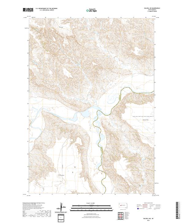
2021 Map of Dalzell NE
USGS Topo · Published 2021About this map
The confluence of the Belle Fourche River and the Cheyenne River anchors this Meade County landscape, where the meandering waterways have carved a complex network of draws and breaks. The terrain transitions from the elevated expanse of Kent Flat in the north to the distinctive high ground of Poverty Point in the southwest. This modern survey illustrates the natural drainage patterns of the western South Dakota plains, featuring seasonal watercourses like Badlands Cr and Plum Draw. Local transit is represented by Dalzell Rd and Vista Pl, while the boundary between Meade and Pennington counties follows the shifting course of the Cheyenne. The map also delineates Duhamel Flat in the east, a feature typical of the alluvial geography found in this river valley region.
Find a feature on this map
18 named features on this map. Tap any name to fly to it.
Don’t see what you’re looking for? This feature index may not catch every label — zoom into the map to look around manually.
Map Details
Editions of this 2021 Dalzell NE Map
This is the sole edition of this map. No revisions or reprints were ever made.
Other maps of this area

1953 · Rapid City
USGS Topo · 1:250,000

1954 · Dalzell SE
USGS Topo · 1:24,000

1954 · Dalzell NW
USGS Topo · 1:24,000

1954 · Dalzell
USGS Topo · 1:24,000

1954 · Dalzell NE
USGS Topo · 1:24,000

1955 · Pedro NW
USGS Topo · 1:24,000

1955 · Creighton
USGS Topo · 1:24,000

1957 · Rapid City
USGS Topo · 1:250,000

1983 · Plainview
USGS Topo · 1:24,000

1983 · Whiteman Owl
USGS Topo · 1:24,000