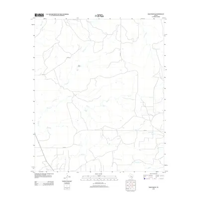
2012 Map of Dam Draw
USGS Topo · Published 2012About this map
Big Silver Creek and Walnut Creek define the drainage patterns of this central Texas landscape, characterized by a series of intermittent streams and ranching infrastructure. The area is marked by the eponymous Dam Draw, a prominent terrain feature that underscores the water management essential to this arid region. Ranching roads like Co RD-337 and Co RD-345 connect the vast rangeland, providing access to essential water sources such as Buck Creek Tank and Six Tank. This 2012 survey illustrates how the landscape is divided into a grid-like network of rural routes, supporting the livestock operations that dominate the vicinity of Buck Creek and Little Silver Creek. The presence of these named tanks and ephemeral creeks provides a clear view of the rural geography in this part of Nolan County.
Find a feature on this map
16 named features on this map. Tap any name to fly to it.
Don’t see what you’re looking for? This feature index may not catch every label — zoom into the map to look around manually.
Map Details
Editions of this 2012 Dam Draw Map
This is the sole edition of this map. No revisions or reprints were ever made.
Other maps of this area

1950 · Colorado City SE
USGS Topo · 1:24,000

1954 · Big Spring
USGS Topo · 1:250,000

1958 · Big Spring
USGS Topo · 1:250,000

1959 · Pecan Crossing
USGS Topo · 1:24,000

1959 · Dam Draw
USGS Topo · 1:24,000

1959 · Silver
USGS Topo · 1:24,000

1959 · Dead Indian Mountain
USGS Topo · 1:24,000

1962 · Sanco
USGS Topo · 1:24,000

1969 · Baumann School
USGS Topo · 1:24,000

1969 · Bench Mountain
USGS Topo · 1:24,000