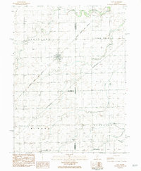
1983 Map of Dana
USGS Topo · Published 1984About this map
The village of Dana stands at the center of this agricultural landscape in the late 1970s and early 1980s, serving as a hub where the Atchison Topeka and Santa Fe railroad bisects the prairie. The map illustrates a transitional period for regional transportation, showing both active rail lines and an Old Railroad Grade near the southern boundary, signifying the shifting importance of rural rail infrastructure.
Find a feature on this map
20 named features on this map. Tap any name to fly to it.
Don’t see what you’re looking for? This feature index may not catch every label — zoom into the map to look around manually.
Map Details
Editions of this 1983 Dana Map
This is the sole edition of this map. No revisions or reprints were ever made.
Other maps of this area

1925 · Streator
USGS Topo · 1:62,500

1927 · Streator
USGS Topo · 1:62,500

1934 · Wenona
USGS Topo · 1:48,000

1939 · Wenona
USGS Topo · 1:62,500

1955 · Minonk
USGS Topo · 1:62,500

1958 · Flanagan
USGS Topo · 1:62,500

1958 · Aurora
USGS Topo · 1:250,000

1958 · Peoria
USGS Topo · 1:250,000

1961 · Aurora
USGS Topo · 1:250,000

1961 · Peoria
USGS Topo · 1:250,000