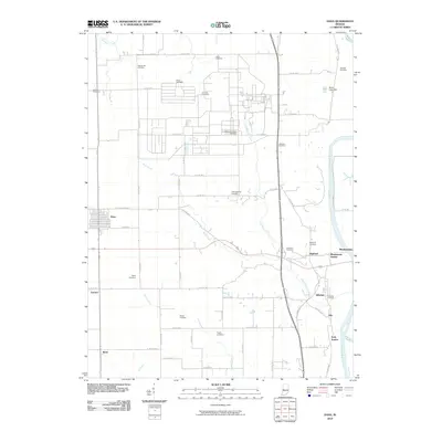
2010 Map of Dana
USGS Topo · Published 2010About this map
Dana and the agricultural lands of western Indiana are depicted here as they appeared in the early 21st century. The landscape is defined by the Wabash River, which forms the eastern boundary of this survey, flanked by several small settlements including Highland, Hillsdale, and Montezuma. This era reveals a region where traditional rail-side stops like Montezuma Station, Hillsdale Junction, and Early Station persist alongside modern county road networks.
Find a feature on this map
66 named features on this map. Tap any name to fly to it.
Don’t see what you’re looking for? This feature index may not catch every label — zoom into the map to look around manually.
Map Details
Editions of this 2010 Dana Map
This is the sole edition of this map. No revisions or reprints were ever made.
Other maps of this area

1947 · Ridge Farm
USGS Topo · 1:62,500

1947 · Paris
USGS Topo · 1:62,500

1949 · Paris
USGS Topo · 1:62,500

1951 · Clinton
USGS Topo · 1:24,000

1951 · Mecca
USGS Topo · 1:24,000

1951 · Saint Bernice
USGS Topo · 1:24,000

1953 · Indianapolis
USGS Topo · 1:250,000

1955 · Kingman
USGS Topo · 1:24,000

1955 · Humrick
USGS Topo · 1:24,000

1955 · Scottland
USGS Topo · 1:24,000