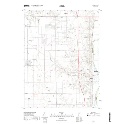
2019 Map of Dana
USGS Topo · Published 2019About this map
The Wabash River forms a significant geographical boundary along the eastern edge of this region, separating Vermillion and Parke counties. This landscape is characterized by its agricultural grid, where small settlements like Dana and Hillsdale serve as focal points for the surrounding rural community. The area east of the river near Montezuma transitions into the river valley, while the interior is dotted with numerous family and community burial grounds, such as Walnut Hill Cem and Juliet Cem, which provide valuable location data for genealogical research. The presence of a Strip Airport and various water bodies like Shell Lake and Little Raccoon Creek highlight the varied land use, from recreational and aviation utility to the natural drainage systems of Buck Creek and Jonathan Creek.
Find a feature on this map
84 named features on this map. Tap any name to fly to it.
Don’t see what you’re looking for? This feature index may not catch every label — zoom into the map to look around manually.
Map Details
Editions of this 2019 Dana Map
This is the sole edition of this map. No revisions or reprints were ever made.
Other maps of this area

1947 · Ridge Farm
USGS Topo · 1:62,500

1947 · Paris
USGS Topo · 1:62,500

1949 · Paris
USGS Topo · 1:62,500

1951 · Clinton
USGS Topo · 1:24,000

1951 · Mecca
USGS Topo · 1:24,000

1951 · Saint Bernice
USGS Topo · 1:24,000

1953 · Indianapolis
USGS Topo · 1:250,000

1955 · Kingman
USGS Topo · 1:24,000

1955 · Humrick
USGS Topo · 1:24,000

1955 · Scottland
USGS Topo · 1:24,000