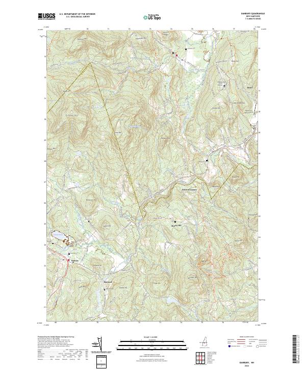
2024 Map of Danbury
USGS Topo · Published 2024About this map
Danbury and South Alexandria sit within a landscape defined by the winding course of the Smith River and the high ridges of the Merrimack and Grafton county line. The transition from active rail to recreation is evident in the Northern Rail Trl, which follows the historic path of the railroad through the western portion of the quadrangle. High points like Forbes Mtn and Periwig Mtn overlook a network of valley settlements and small water bodies including Foster Pond and School Pond.
Find a feature on this map
139 named features on this map. Tap any name to fly to it.
Don’t see what you’re looking for? This feature index may not catch every label — zoom into the map to look around manually.
Map Details
Editions of this 2024 Danbury Map
This is the sole edition of this map. No revisions or reprints were ever made.
Other maps of this area

1925 · Holderness
USGS Topo · 1:62,500

1927 · Penacook
USGS Topo · 1:62,500

1927 · Holderness
USGS Topo · 1:62,500

1927 · Cardigan
USGS Topo · 1:62,500

1928 · Mount Kearsarge
USGS Topo · 1:62,500

1930 · Cardigan
USGS Topo · 1:62,500

1931 · Mount Kearsarge
USGS Topo · 1:62,500

1949 · Portland
USGS Topo · 1:250,000

1956 · Cardigan
USGS Topo · 1:62,500

1956 · Penacook
USGS Topo · 1:62,500