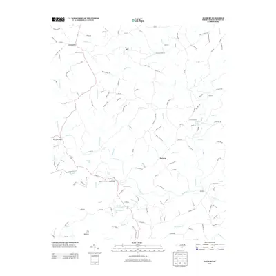
2013 Map of Danbury
USGS Topo · Published 2013About this map
Danbury serves as the focal point of this Stokes County landscape, situated along a prominent bend in the Dan River. The river's influence is evident in the surrounding infrastructure and history, most notably at the Moratuck Furnace, which speaks to the area's early industrial heritage. North of the river, the terrain is defined by the winding course of Snow Cr and its tributaries, while the southern portion is dominated by the elevation of Flat Shoal Mountain.
Find a feature on this map
141 named features on this map. Tap any name to fly to it.
Don’t see what you’re looking for? This feature index may not catch every label — zoom into the map to look around manually.
Map Details
Editions of this 2013 Danbury Map
This is the sole edition of this map. No revisions or reprints were ever made.
Other maps of this area

1926 · Critz
USGS Topo · 1:48,000

1928 · Stuart
USGS Topo · 1:48,000

1928 · Critz
USGS Topo · 1:62,500

1931 · Stuart
USGS Topo · 1:62,500

1953 · Winston-Salem
USGS Topo · 1:250,000

1955 · Winston-Salem
USGS Topo · 1:250,000

1962 · Winston-Salem
USGS Topo · 1:250,000

1964 · Hanging Rock
USGS Topo · 1:24,000

1964 · King
USGS Topo · 1:24,000
1967 · Spencer
USGS Topo · 1:24,000