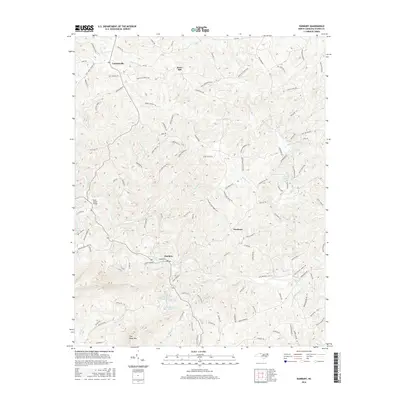
2016 Map of Danbury
USGS Topo · Published 2016About this map
The Dan River winds through the heart of Stokes County, defining the local geography as it flows past the historic county seat of Danbury. This 2016 survey illustrates a landscape of high ridges and narrow creek valleys, dominated in the south by the prominent rise of Flat Shoal Mtn. Small settlements such as Lawsonville, Snow Hill, and Hartman are connected by a network of rural roads that often trace the spines of these ridges, such as Snow Hill Church Rd and Chestnut Ridge Ln. The area is notably dense with water features, from the Buck Island Bridge crossing to numerous small impoundments like Stedman Lake, Scott Lake, and Camelot Woods Lake. The drainage pattern is intricate, with Little Snow Cr, Mill Cr, and Sandy Run carving the terrain into a complex system of hollows and heights that has shaped the region's development for generations.
Find a feature on this map
128 named features on this map. Tap any name to fly to it.
Don’t see what you’re looking for? This feature index may not catch every label — zoom into the map to look around manually.
Map Details
Editions of this 2016 Danbury Map
This is the sole edition of this map. No revisions or reprints were ever made.
Other maps of this area

1926 · Critz
USGS Topo · 1:48,000

1928 · Stuart
USGS Topo · 1:48,000

1928 · Critz
USGS Topo · 1:62,500

1931 · Stuart
USGS Topo · 1:62,500

1953 · Winston-Salem
USGS Topo · 1:250,000

1955 · Winston-Salem
USGS Topo · 1:250,000

1962 · Winston-Salem
USGS Topo · 1:250,000

1964 · Hanging Rock
USGS Topo · 1:24,000

1964 · King
USGS Topo · 1:24,000
1967 · Spencer
USGS Topo · 1:24,000