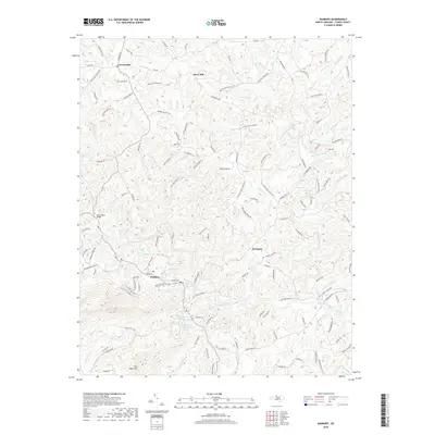
2019 Map of Danbury
USGS Topo · Published 2019About this map
The Dan River carves a deep path through the center of this terrain, anchoring the settlement of Danbury in the southern half of the quadrangle. As the county seat, Danbury's layout is defined by its proximity to the river and the surrounding elevations of Flat Shoal Mtn. To the north, the communities of Lawsonville, Snow Hill, and Hartman are connected by a network of rural roads that follow the ridges between numerous tributaries like Little Snow Cr and Sandy Run.
Find a feature on this map
132 named features on this map. Tap any name to fly to it.
Don’t see what you’re looking for? This feature index may not catch every label — zoom into the map to look around manually.
Map Details
Editions of this 2019 Danbury Map
This is the sole edition of this map. No revisions or reprints were ever made.
Other maps of this area

1926 · Critz
USGS Topo · 1:48,000

1928 · Stuart
USGS Topo · 1:48,000

1928 · Critz
USGS Topo · 1:62,500

1931 · Stuart
USGS Topo · 1:62,500

1953 · Winston-Salem
USGS Topo · 1:250,000

1955 · Winston-Salem
USGS Topo · 1:250,000

1962 · Winston-Salem
USGS Topo · 1:250,000

1964 · Hanging Rock
USGS Topo · 1:24,000

1964 · King
USGS Topo · 1:24,000
1967 · Spencer
USGS Topo · 1:24,000