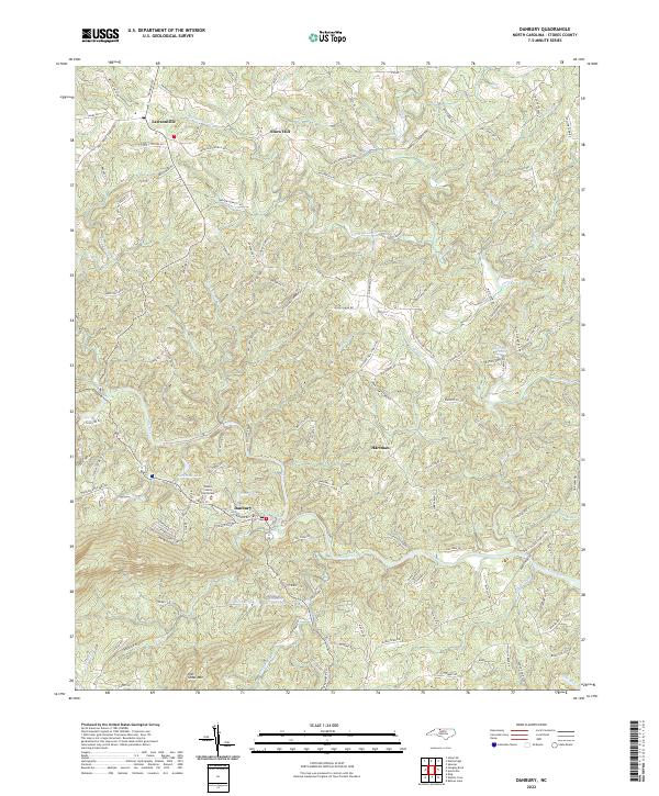
2022 Map of Danbury
USGS Topo · Published 2022About this map
Danbury serves as the focal point of this northern Piedmont landscape, situated along the winding course of the Dan River. As the county seat, it houses the Stokes County Courthouse, anchoring a region defined by a mix of river-bottom lowlands and high-relief terrain like Flat Shoal Mtn. The map reveals a settlement pattern of small communities such as Lawsonville, Snow Hill, and Hartman, connected by a dense network of family-named roads like Peter Mabe Rd and Andrew Bennett Rd. This modern survey illustrates the proximity of the town to the eastern edges of Hanging Rock State Park, where the geography transitions into more varied elevations. Numerous small reservoirs and ponds, including Taylor Lake, Scott Lake, and Mitchells Pond, are scattered throughout the drainages of Snow Creek and Seven Island Cr, reflecting the region's managed water resources.
Find a feature on this map
131 named features on this map. Tap any name to fly to it.
Don’t see what you’re looking for? This feature index may not catch every label — zoom into the map to look around manually.
Map Details
Editions of this 2022 Danbury Map
This is the sole edition of this map. No revisions or reprints were ever made.
Other maps of this area

1926 · Critz
USGS Topo · 1:48,000

1928 · Stuart
USGS Topo · 1:48,000

1928 · Critz
USGS Topo · 1:62,500

1931 · Stuart
USGS Topo · 1:62,500

1953 · Winston-Salem
USGS Topo · 1:250,000

1955 · Winston-Salem
USGS Topo · 1:250,000

1962 · Winston-Salem
USGS Topo · 1:250,000

1964 · Hanging Rock
USGS Topo · 1:24,000

1964 · King
USGS Topo · 1:24,000
1967 · Spencer
USGS Topo · 1:24,000