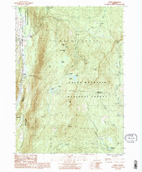
1986 Map of Danby
USGS Topo · Published 1987About this map
Danby and Mount Tabor anchor the western valley of this 1980s survey, where the Otter Creek drainage meets the steep ascent of the southern Green Mountains. The landscape is dominated by the Green Mountain National Forest, a terrain of high-altitude peaks including Peru Peak and Styles Peak. This era of the map captures the overlap of the Appalachian Trail and the Long Trail as they traverse the ridgeline, passing significant waypoints like Griffith Lake and the shelter at Old Job. The settlement patterns are concentrated along the valley floor, specifically at South End, where the South End Cem remains a primary genealogical landmark. Beyond the developed corridors, the map reveals a network of remote water bodies and wetlands such as Big Mud Pond, Little Mud Pond, and the Elbow Swamp, illustrating the heavy drainage patterns of the Big Branch and Utley Brook systems.
Find a feature on this map
44 named features on this map. Tap any name to fly to it.
Don’t see what you’re looking for? This feature index may not catch every label — zoom into the map to look around manually.
Map Details
Editions of this 1986 Danby Map
2 editions found
Other maps of this area

1893 · Wallingford
USGS Topo · 1:62,500

1894 · Londonderry
USGS Topo · 1:62,500

1894 · Pawlet
USGS Topo · 1:62,500

1894 · Equinox
USGS Topo · 1:62,500

1896 · Equinox
USGS Topo · 1:62,500

1897 · Pawlet
USGS Topo · 1:62,500

1899 · Londonderry
USGS Topo · 1:62,500

1900 · Equinox
USGS Topo · 1:62,500

1903 · Mettawee
USGS Topo · 1:125,000

1950 · Glens Falls
USGS Topo · 1:250,000