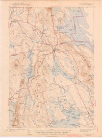
1943 Map of Danforth
USGS Topo · Published 1943About this map
Danforth and Brookton serve as the primary hubs in this lake-rich region of eastern Maine, situated at the boundary of Aroostook and Washington Counties. The landscape is defined by the intricate waterways of Baskahegan Lake, Brackett Lake, and the expansive Chiputneticook Lakes along the international border with Canada. Transportation and industry follow the Canadian Pacific and Central Maine rail lines, which intersect the terrain near Croperly Turn and the Baskahegan Stream. Outside the primary villages, the area is dotted with small-scale rural infrastructure, including the Ridge Sch, Butterfield Sch, and Shaw Sch. Notable local landmarks like the Irish Settlement and various logging or sporting camps such as Muncey Camp and Deadman Camp illustrate the era's reliance on timber and seasonal backwoods labor. The terrain rises sharply at Stetson Mountain and Snow Mountain, providing a clear view of the complex system of bogs and flowages that feed the Mattawamkeag River basin.
Find a feature on this map
131 named features on this map. Tap any name to fly to it.
Don’t see what you’re looking for? This feature index may not catch every label — zoom into the map to look around manually.
Map Details
Editions of this 1943 Danforth Map
3 editions found

Other maps of this area

1931 · Springfield
USGS Topo · 1:48,000

1934 · Springfield
USGS Topo · 1:62,500

1940 · Danforth
USGS Topo · 1:62,500

1940 · Amity
USGS Topo · 1:62,500

1940 · Waite
USGS Topo · 1:62,500

1940 · Forest
USGS Topo · 1:62,500

1941 · Danforth
USGS Topo · 1:62,500

1941 · Amity
USGS Topo · 1:62,500

1941 · Scraggly Lake
USGS Topo · 1:62,500

1941 · Mattawamkeag Lake
USGS Topo · 1:62,500