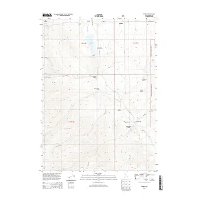
2013 Map of Daniels
USGS Topo · Published 2013About this map
Daniels Reservoir and its associated Public Fishing Area form the central hydrological feature of this Oneida County landscape, fed by Wright Cr and the Little Malad River. The terrain is defined by a series of deep cuts through the Pleasantview Hills, including Sublette Canyon and Morgan Jones Canyon. In the north, the small settlement of Daniels sits near the headwaters of Hill Cr, while the southeastern corner reaches into the boundaries of the Caribou National Forest.
Find a feature on this map
34 named features on this map. Tap any name to fly to it.
Don’t see what you’re looking for? This feature index may not catch every label — zoom into the map to look around manually.
Map Details
Editions of this 2013 Daniels Map
This is the sole edition of this map. No revisions or reprints were ever made.
Other maps of this area

1954 · Pocatello
USGS Topo · 1:250,000

1958 · Pocatello
USGS Topo · 1:250,000

1963 · Daniels
USGS Topo · 1:24,000

1968 · Ireland Springs
USGS Topo · 1:24,000

1968 · Daniels
USGS Topo · 1:24,000

1968 · Dairy Creek
USGS Topo · 1:24,000

1968 · Malad City West
USGS Topo · 1:24,000

1968 · Wakley Peak
USGS Topo · 1:24,000
1968 · Elkhorn Peak
USGS Topo · 1:24,000
1973 · Arbon
USGS Topo · 1:24,000