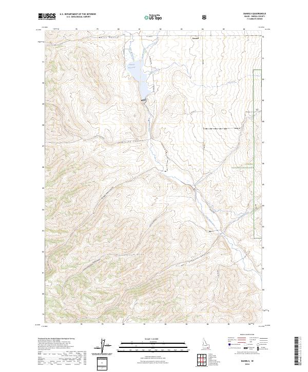
2024 Map of Daniels
USGS Topo · Published 2024About this map
Daniels stands as the primary settlement hub in this high-altitude Oneida County landscape, where the Little Malad River and its tributaries carve a complex network of drainages. The Daniels Reservoir serves as a significant hydrologic feature, collecting water from Wright Creek and the river before it continues southward through the canyon systems. To the east, the protected lands of the Curlew National Grassland border the rugged Pleasantview Hills, illustrating the intersection of public land management and traditional Idaho ranching country. A grid of rural routes, including W Daniels Rd and Sublette Canyon Rd, provides access to various topographic landmarks such as Sublette Canyon and White Hollow. This area reflects a long-standing reliance on water resources for high-desert agriculture, visible in the way the road network follows the natural contours of the valley floors and canyon passes.
Find a feature on this map
26 named features on this map. Tap any name to fly to it.
Don’t see what you’re looking for? This feature index may not catch every label — zoom into the map to look around manually.
Map Details
Editions of this 2024 Daniels Map
This is the sole edition of this map. No revisions or reprints were ever made.
Other maps of this area

1954 · Pocatello
USGS Topo · 1:250,000

1958 · Pocatello
USGS Topo · 1:250,000

1963 · Daniels
USGS Topo · 1:24,000

1968 · Ireland Springs
USGS Topo · 1:24,000

1968 · Daniels
USGS Topo · 1:24,000

1968 · Dairy Creek
USGS Topo · 1:24,000

1968 · Malad City West
USGS Topo · 1:24,000

1968 · Wakley Peak
USGS Topo · 1:24,000
1968 · Elkhorn Peak
USGS Topo · 1:24,000
1973 · Arbon
USGS Topo · 1:24,000