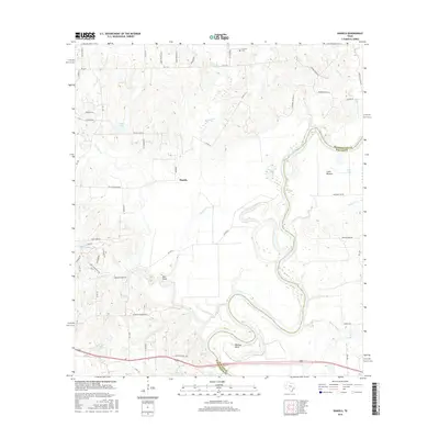
2016 Map of Daniels
USGS Topo · Published 2016About this map
The Brazos River carves a winding course through this landscape along the border of Washington and Waller counties, defining a terrain of oxbows and fertile lowlands like Clark Bottom. The rural settlement of Daniels serves as a central point in a region characterized by family-named tracks and historic thoroughfares, including Old Plantation Rd and Old Stagecoach Rd. This network of roads suggests a deep-rooted agricultural history, connecting scattered homesteads to local water sources such as New Year Creek and Jackson Cr.
Find a feature on this map
62 named features on this map. Tap any name to fly to it.
Don’t see what you’re looking for? This feature index may not catch every label — zoom into the map to look around manually.
Map Details
Editions of this 2016 Daniels Map
This is the sole edition of this map. No revisions or reprints were ever made.
Other maps of this area

1914 · Gay Hill
USGS Topo · 1:62,500

1914 · Navasota
USGS Topo · 1:62,500

1930 · Brenham
USGS Topo · 1:62,500

1954 · Austin
USGS Topo · 1:250,000

1956 · Hempstead
USGS Topo · 1:62,500

1956 · Brenham
USGS Topo · 1:62,500

1958 · Washington
USGS Topo · 1:24,000

1958 · Courtney
USGS Topo · 1:24,000

1959 · Independence
USGS Topo · 1:24,000
1961 · Hempstead
USGS Topo · 1:24,000