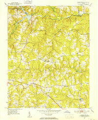
1951 Map of Danieltown
USGS Topo · Published 1952About this map
Camp Pickett Military Reservation dominates the northern reaches of this rural landscape, where the Nottoway River serves as a natural boundary between Nottoway and Brunswick counties. The 1950s terrain is a dense network of small family-named landmarks and rural institutions, centered around the settlement of Danieltown. Transportation and commerce in this era are anchored by the Virginian railway and crossroads like Warrens Store.
Find a feature on this map
38 named features on this map. Tap any name to fly to it.
Don’t see what you’re looking for? This feature index may not catch every label — zoom into the map to look around manually.
Map Details
Editions of this 1951 Danieltown Map
4 editions found
Other maps of this area

1891 · Farmville
USGS Topo · 1:125,000

1893 · Farmville
USGS Topo · 1:125,000

1897 · Amelia
USGS Topo · 1:125,000

1918 · Lawrenceville
USGS Topo · 1:62,500

1920 · Lawrenceville
USGS Topo · 1:48,000

1921 · Lawrenceville
USGS Topo · 1:62,500

1942 · Lawrenceville
USGS Topo · 1:62,500

1943 · Richmond
USGS Topo · 1:250,000

1947 · Roanoke
USGS Topo · 1:250,000

1949 · Richmond
USGS Topo · 1:250,000