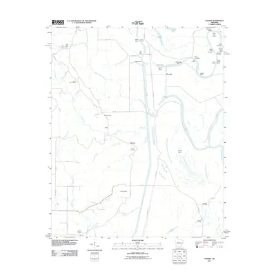
2011 Map of Dansby
USGS Topo · Published 2011About this map
The Saint Francis River dominates this landscape, creating a complex geography of meandering bends and alluvial islands in eastern Arkansas. The river’s natural course is defined by series of sharp turns such as Sassafrass Bend, Overcup Bend, and Coon Island Bend, while the modern engineering of the St Francis Floodway cuts a straight north-south path to manage seasonal drainage. Small rural communities including Tuni, Dansby, and Tuttleton serve as central points for local history, often anchored by their proximity to the river or various creek systems like Tuni Creek and Poplar Creek. Genealogists will find a high density of family and community burial sites, including Mount Zion Cemetery, Saint John Cemetery, and Casteel Cemetery. The map also documents a vanished educational landscape at School House Bend and a series of historical river crossings, such as Quigley Crossing and Jarvis Crossing, that once linked these isolated settlements across the wetlands.
Find a feature on this map
72 named features on this map. Tap any name to fly to it.
Don’t see what you’re looking for? This feature index may not catch every label — zoom into the map to look around manually.
Map Details
Editions of this 2011 Dansby Map
This is the sole edition of this map. No revisions or reprints were ever made.
Other maps of this area

1939 · Park Place
USGS Topo · 1:62,500

1939 · Wynne
USGS Topo · 1:62,500

1940 · Whitmore
USGS Topo · 1:62,500

1940 · Marianna
USGS Topo · 1:62,500

1948 · Helena
USGS Topo · 1:250,000

1950 · Helena
USGS Topo · 1:250,000

1953 · Memphis
USGS Topo · 1:250,000

1955 · Park Place
USGS Topo · 1:62,500

1955 · Helena
USGS Topo · 1:250,000

1956 · Memphis
USGS Topo · 1:250,000