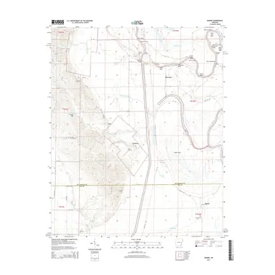
2014 Map of Dansby
USGS Topo · Published 2014About this map
Crowley Ridge rises sharply out of the low-lying wetlands of eastern Arkansas, forming a dramatic geological contrast to the alluvial plains of the Saint Francis River. This transition zone is marked by small settlements and historic cemeteries like Mt Zion Cem and Shady Grove Cem, which follow the higher ground provided by the ridge's western flank. To the east, the landscape is defined by the winding course of the Saint Francis River, where numerous oxbows and bends—such as Quigley Bend and Pretty Tree Bend—illustrate the river's historical movement. Small communities like Tuni, Tuttleton, and Dansby are scattered across the flats, often anchored near these watercourses or at road junctions. The mapping of Linden Island and the complex network of sloughs like Wyles Pond Slough reveal an area where the water table and seasonal flooding have long dictated the patterns of agriculture and human habitation.
Find a feature on this map
83 named features on this map. Tap any name to fly to it.
Don’t see what you’re looking for? This feature index may not catch every label — zoom into the map to look around manually.
Map Details
Editions of this 2014 Dansby Map
This is the sole edition of this map. No revisions or reprints were ever made.
Other maps of this area

1939 · Park Place
USGS Topo · 1:62,500

1939 · Wynne
USGS Topo · 1:62,500

1940 · Whitmore
USGS Topo · 1:62,500

1940 · Marianna
USGS Topo · 1:62,500

1948 · Helena
USGS Topo · 1:250,000

1950 · Helena
USGS Topo · 1:250,000

1953 · Memphis
USGS Topo · 1:250,000

1955 · Park Place
USGS Topo · 1:62,500

1955 · Helena
USGS Topo · 1:250,000

1956 · Memphis
USGS Topo · 1:250,000