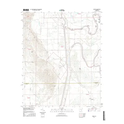
2017 Map of Dansby
USGS Topo · Published 2017About this map
The Saint Francis River dominates this landscape, winding through a complex network of bayous and sloughs along the border of St. Francis and Lee Counties. The terrain is defined by the elevation of Crowley Ridge to the west, which contrasts sharply with the low-lying wetlands of the eastern alluvial plain. Numerous family and community burial grounds, including Linden Cem, Dansby Cem, and Casteel Cem, are scattered across the area, providing critical markers for genealogical research. The settlement of Dansby sits near the southern edge of the quadrangle, connected to the surrounding countryside by a grid of county roads and State Hwy 131. The river's serpentine course has created distinctive landmarks such as Overcup Bend and Sassafrass Bend, while Linden Island stands as a significant landform within the river's path. Local infrastructure includes the Blackfish Cut-off, which manages the water flow through this flood-prone region.
Find a feature on this map
74 named features on this map. Tap any name to fly to it.
Don’t see what you’re looking for? This feature index may not catch every label — zoom into the map to look around manually.
Map Details
Editions of this 2017 Dansby Map
This is the sole edition of this map. No revisions or reprints were ever made.
Other maps of this area

1939 · Park Place
USGS Topo · 1:62,500

1939 · Wynne
USGS Topo · 1:62,500

1940 · Whitmore
USGS Topo · 1:62,500

1940 · Marianna
USGS Topo · 1:62,500

1948 · Helena
USGS Topo · 1:250,000

1950 · Helena
USGS Topo · 1:250,000

1953 · Memphis
USGS Topo · 1:250,000

1955 · Park Place
USGS Topo · 1:62,500

1955 · Helena
USGS Topo · 1:250,000

1956 · Memphis
USGS Topo · 1:250,000