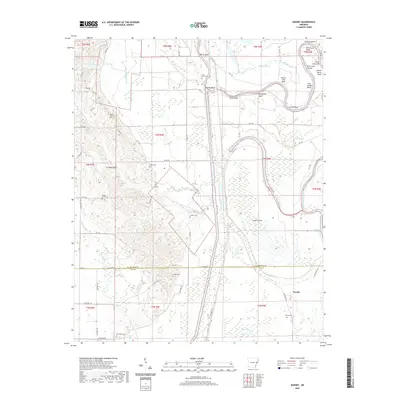
2020 Map of Dansby
USGS Topo · Published 2020About this map
Saint Francis River meanders through this landscape, defining a complex system of oxbows and sloughs including Loeb Lake, Skinny Lake, and Hidden Slough. The river's winding path creates distinctive landforms such as Point Look Around, Coon Island Bend, and Linden Island. The western portion of the area is marked by the elevated terrain of Crowley Ridge, where several small family cemeteries are situated, including Wyles Cem and Shady Grove Cem.
Find a feature on this map
77 named features on this map. Tap any name to fly to it.
Don’t see what you’re looking for? This feature index may not catch every label — zoom into the map to look around manually.
Map Details
Editions of this 2020 Dansby Map
This is the sole edition of this map. No revisions or reprints were ever made.
Other maps of this area

1939 · Park Place
USGS Topo · 1:62,500

1939 · Wynne
USGS Topo · 1:62,500

1940 · Whitmore
USGS Topo · 1:62,500

1940 · Marianna
USGS Topo · 1:62,500

1948 · Helena
USGS Topo · 1:250,000

1950 · Helena
USGS Topo · 1:250,000

1953 · Memphis
USGS Topo · 1:250,000

1955 · Park Place
USGS Topo · 1:62,500

1955 · Helena
USGS Topo · 1:250,000

1956 · Memphis
USGS Topo · 1:250,000