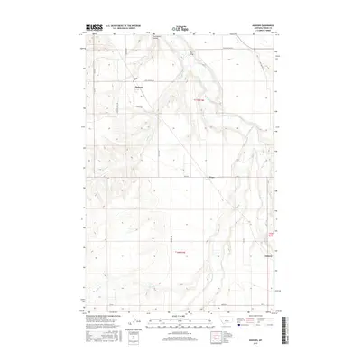
2017 Map of Danvers
USGS Topo · Published 2017About this map
Danvers and the agricultural lands of Fergus County are defined by the winding course of the Judith River, which cuts a deep, meandering path through the central plateau. This modern survey captures the rural infrastructure of the region, from the small cluster at Ware to the southern settlement of Amherst. The terrain is marked by significant drainages including Indian Cr, Louse Cr, and Scotchman Coulee, reflecting a landscape shaped by persistent water action in an otherwise arid environment.
Find a feature on this map
25 named features on this map. Tap any name to fly to it.
Don’t see what you’re looking for? This feature index may not catch every label — zoom into the map to look around manually.
Map Details
Editions of this 2017 Danvers Map
This is the sole edition of this map. No revisions or reprints were ever made.
Other maps of this area

1954 · Lewistown
USGS Topo · 1:250,000

1959 · Lewistown
USGS Topo · 1:250,000

1970 · Harwood Bench
USGS Topo · 1:24,000

1970 · Danvers
USGS Topo · 1:24,000

1970 · Glengarry
USGS Topo · 1:24,000
1970 · Kolin
USGS Topo · 1:24,000

1970 · Spring Creek Junction
USGS Topo · 1:24,000
1970 · Ross Fork
USGS Topo · 1:24,000

1978 · Toney Bench
USGS Topo · 1:24,000
1978 · Hoosac
USGS Topo · 1:24,000