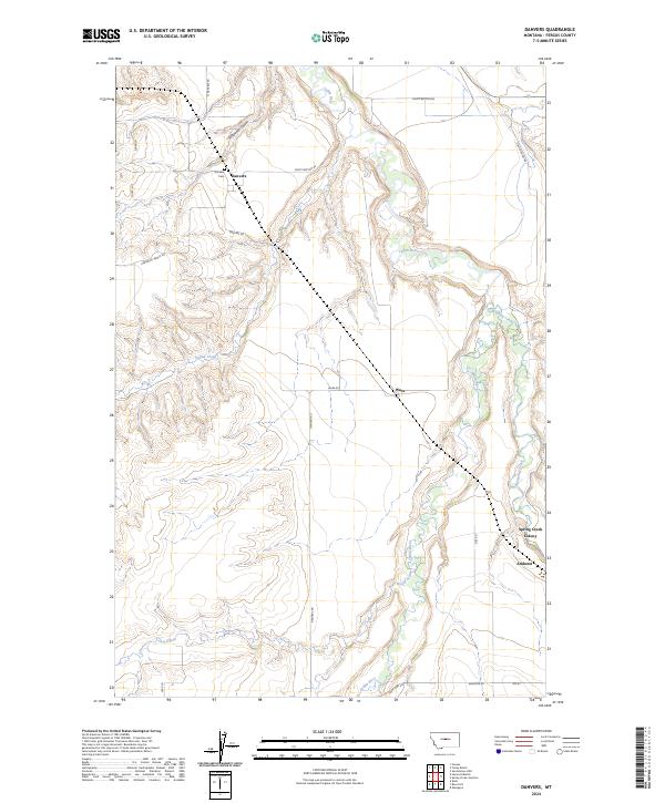
2024 Map of Danvers
USGS Topo · Published 2024About this map
The Judith River cuts a winding path through this portion of Fergus County, where high plateaus like Harwood Bench RD drop away into deep drainage features like Scotchman Coulee. Small agricultural settlements and communal outposts define the human footprint here, anchored by the community of Danvers in the northwest and Ware near the center. The presence of Spring Creek Colony and the nearby village of Amherst on the eastern edge illustrates the area's continued reliance on the fertile lands adjacent to Big Spring Creek. This landscape is primarily shaped by the intersection of water and ranching, with a network of local connectors such as N Danvers RD and Gies RD linking isolated homesteads to these central hubs and the Danvers Cem.
Find a feature on this map
27 named features on this map. Tap any name to fly to it.
Don’t see what you’re looking for? This feature index may not catch every label — zoom into the map to look around manually.
Map Details
Editions of this 2024 Danvers Map
This is the sole edition of this map. No revisions or reprints were ever made.
Other maps of this area

1954 · Lewistown
USGS Topo · 1:250,000

1959 · Lewistown
USGS Topo · 1:250,000

1970 · Harwood Bench
USGS Topo · 1:24,000

1970 · Danvers
USGS Topo · 1:24,000

1970 · Glengarry
USGS Topo · 1:24,000
1970 · Kolin
USGS Topo · 1:24,000

1970 · Spring Creek Junction
USGS Topo · 1:24,000
1970 · Ross Fork
USGS Topo · 1:24,000

1978 · Toney Bench
USGS Topo · 1:24,000
1978 · Hoosac
USGS Topo · 1:24,000