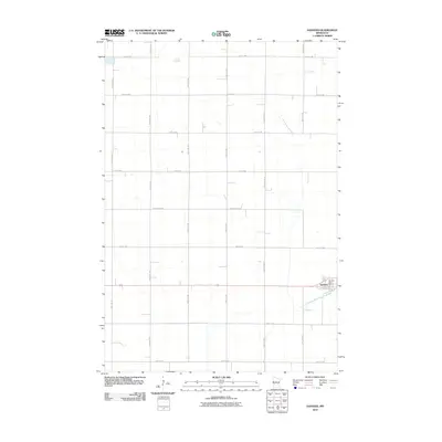
2010 Map of Danvers
USGS Topo · Published 2010About this map
Danvers serves as the primary settlement hub for this agricultural portion of Swift County, centered near the intersection of the regional rail line and Maryland Ave. The landscape is defined by the rigid grid of the Public Land Survey System, with gravel and paved roads such as 140th Ave NW and 50th St NW marking nearly every section line. This layout reflects the intensive farm-to-market infrastructure necessary for local commerce.
Find a feature on this map
24 named features on this map. Tap any name to fly to it.
Don’t see what you’re looking for? This feature index may not catch every label — zoom into the map to look around manually.
Map Details
Editions of this 2010 Danvers Map
This is the sole edition of this map. No revisions or reprints were ever made.
Other maps of this area

1953 · Saint Cloud
USGS Topo · 1:250,000

1957 · Saint Cloud
USGS Topo · 1:250,000

1958 · Saint Cloud
USGS Topo · 1:250,000

1958 · Big Bend City
USGS Topo · 1:24,000

1958 · Milan NW
USGS Topo · 1:24,000

1958 · Gracelock NW
USGS Topo · 1:24,000

1968 · Danvers
USGS Topo · 1:24,000

1968 · Hancock
USGS Topo · 1:24,000
1968 · Hancock SW
USGS Topo · 1:24,000
1968 · Clontarf North
USGS Topo · 1:24,000