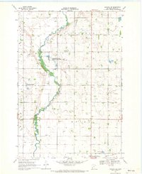
1968 Map of Hancock SW
USGS Topo · Published 1970About this map
The Pomme De Terre River winds through this rural landscape on the border of Stevens and Swift counties, defining a valley marked by numerous conservation tracts. In the late 1960s, this area supported several distinct religious and burial sites, including the Trinity Ch and its associated Trinity Ch Cem, alongside Smith-Kepner Cem and Evangelical Cem. These landmarks, often established by early settler families, punctuate the agricultural sections of Fairfield and Moyer townships.
Find a feature on this map
20 named features on this map. Tap any name to fly to it.
Don’t see what you’re looking for? This feature index may not catch every label — zoom into the map to look around manually.
Map Details
Editions of this 1968 Hancock SW Map
2 editions found
Other maps of this area

1953 · Milbank
USGS Topo · 1:250,000

1953 · Saint Cloud
USGS Topo · 1:250,000

1957 · Saint Cloud
USGS Topo · 1:250,000

1958 · Milbank
USGS Topo · 1:250,000

1958 · Saint Cloud
USGS Topo · 1:250,000

1958 · Big Bend City
USGS Topo · 1:24,000

1958 · Milan NW
USGS Topo · 1:24,000

1958 · Appleton
USGS Topo · 1:24,000

1968 · Dry Wood Lake
USGS Topo · 1:24,000

1968 · Lake Oliver
USGS Topo · 1:24,000