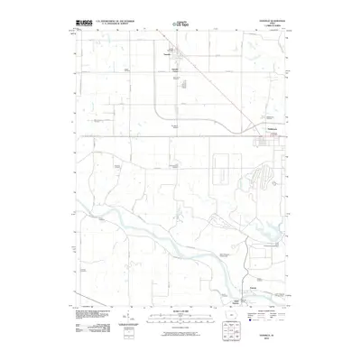
2010 Map of Danville
USGS Topo · Published 2010About this map
The Skunk River carves a winding path across this portion of Des Moines County, defining a landscape marked by small agricultural settlements and a high density of family burial grounds. The community of Danville serves as a central hub, supported by Danville Center and the nearby Danville Post Office. To the east, the village of Middletown sits near the Middletown Cemetery, while the southern reaches of the map are anchored by Augusta and South Augusta along the riverbanks.
Find a feature on this map
55 named features on this map. Tap any name to fly to it.
Don’t see what you’re looking for? This feature index may not catch every label — zoom into the map to look around manually.
Map Details
Editions of this 2010 Danville Map
This is the sole edition of this map. No revisions or reprints were ever made.
Other maps of this area

1932 · Lomax
USGS Topo · 1:62,500

1934 · Burlington
USGS Topo · 1:48,000

1936 · Fort Madison
USGS Topo · 1:62,500

1937 · Lomax
USGS Topo · 1:62,500

1940 · Burlington
USGS Topo · 1:62,500

1958 · Burlington
USGS Topo · 1:250,000

1961 · Burlington
USGS Topo · 1:250,000

1963 · Burlington
USGS Topo · 1:250,000

1964 · West Point
USGS Topo · 1:24,000
1964 · West Burlington
USGS Topo · 1:24,000