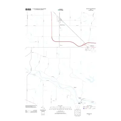
2013 Map of Danville
USGS Topo · Published 2013About this map
Danville serves as the primary hub of this eastern Iowa landscape, situated along the corridor of Co Hwy-34. The area is defined by the winding course of the Skunk River as it passes through the southern portion of the quadrangle, creating a distinct topographical boundary near Augusta and South Augusta. To the east, Middletown anchors the border, while the interior is dotted with localized points of interest such as the McCoy Airport and The Secret Garden. Waterways like Long Cr and Deeds Cr drain the surrounding agricultural lands, flowing toward the river valley. The map reveals a transition from the structured street grids of the small towns to the broader network of rural routes, including Jimtown Rd and Agency Rd, which reflect the region's enduring farming heritage and established transport patterns.
Find a feature on this map
67 named features on this map. Tap any name to fly to it.
Don’t see what you’re looking for? This feature index may not catch every label — zoom into the map to look around manually.
Map Details
Editions of this 2013 Danville Map
This is the sole edition of this map. No revisions or reprints were ever made.
Other maps of this area

1932 · Lomax
USGS Topo · 1:62,500

1934 · Burlington
USGS Topo · 1:48,000

1936 · Fort Madison
USGS Topo · 1:62,500

1937 · Lomax
USGS Topo · 1:62,500

1940 · Burlington
USGS Topo · 1:62,500

1958 · Burlington
USGS Topo · 1:250,000

1961 · Burlington
USGS Topo · 1:250,000

1963 · Burlington
USGS Topo · 1:250,000

1964 · West Point
USGS Topo · 1:24,000
1964 · West Burlington
USGS Topo · 1:24,000