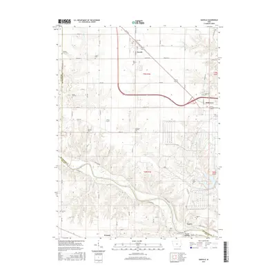
2015 Map of Danville
USGS Topo · Published 2015About this map
Danville and Middletown anchor this southeastern Iowa landscape, where the agricultural grid of Des Moines County meets the winding course of the Skunk River. The area is notably dense with small family and community burial sites, including the Old Danville Cem, Jaggar Cem, and the secluded Lee Burial Plot near the river bluffs. These locations, along with the Long Creek Methodist Cem, provide essential anchor points for genealogical research in a region defined by its deep-rooted farming heritage.
Find a feature on this map
68 named features on this map. Tap any name to fly to it.
Don’t see what you’re looking for? This feature index may not catch every label — zoom into the map to look around manually.
Map Details
Editions of this 2015 Danville Map
This is the sole edition of this map. No revisions or reprints were ever made.
Other maps of this area

1932 · Lomax
USGS Topo · 1:62,500

1934 · Burlington
USGS Topo · 1:48,000

1936 · Fort Madison
USGS Topo · 1:62,500

1937 · Lomax
USGS Topo · 1:62,500

1940 · Burlington
USGS Topo · 1:62,500

1958 · Burlington
USGS Topo · 1:250,000

1961 · Burlington
USGS Topo · 1:250,000

1963 · Burlington
USGS Topo · 1:250,000

1964 · West Point
USGS Topo · 1:24,000
1964 · West Burlington
USGS Topo · 1:24,000