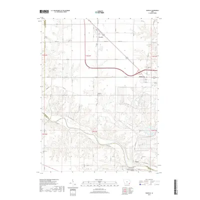
2018 Map of Danville
USGS Topo · Published 2018About this map
The Skunk River meanders across the southern landscape of this Des Moines County region, defining the valley between Augusta and South Augusta. To the north, the upland prairie is anchored by the established communities of Danville and Middletown, which developed along the transport corridor now dominated by E Old Highway 34. The settlement pattern is characterized by its numerous small burial sites and family plots, offering significant data for local genealogists.
Find a feature on this map
45 named features on this map. Tap any name to fly to it.
Don’t see what you’re looking for? This feature index may not catch every label — zoom into the map to look around manually.
Map Details
Editions of this 2018 Danville Map
This is the sole edition of this map. No revisions or reprints were ever made.
Other maps of this area

1932 · Lomax
USGS Topo · 1:62,500

1934 · Burlington
USGS Topo · 1:48,000

1936 · Fort Madison
USGS Topo · 1:62,500

1937 · Lomax
USGS Topo · 1:62,500

1940 · Burlington
USGS Topo · 1:62,500

1958 · Burlington
USGS Topo · 1:250,000

1961 · Burlington
USGS Topo · 1:250,000

1963 · Burlington
USGS Topo · 1:250,000

1964 · West Point
USGS Topo · 1:24,000
1964 · West Burlington
USGS Topo · 1:24,000