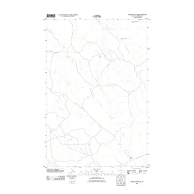
2011 Map of Darby Buttes SW
USGS Topo · Published 2011About this map
Wolf Springs and a series of water management structures define this section of Garfield County, Montana. The drainage patterns are dictated by numerous seasonal waterways, including Santo Arroyo Creek, Wolf Creek, and Badger Creek, which carve through the open plains. Man-made interventions in this arid landscape are evident through several earthworks, such as the Edwards Reservoir Dam, Edwards Number 1 Dam, and Virginia Dam. These features suggest a landscape centered on ranching and water conservation in the early 21st century. Transportation is limited to a sparse network of local routes like West Little Dry Rd, reflecting the low-density settlement of this region.
Find a feature on this map
13 named features on this map. Tap any name to fly to it.
Don’t see what you’re looking for? This feature index may not catch every label — zoom into the map to look around manually.
Map Details
Editions of this 2011 Darby Buttes SW Map
This is the sole edition of this map. No revisions or reprints were ever made.
Other maps of this area

1954 · Jordan
USGS Topo · 1:250,000

1954 · Forsyth
USGS Topo · 1:250,000

1956 · Jordan
USGS Topo · 1:250,000

1957 · Forsyth
USGS Topo · 1:250,000

1958 · Jordan
USGS Topo · 1:250,000

1958 · Forsyth
USGS Topo · 1:250,000

1964 · Jordan
USGS Topo · 1:250,000

1965 · Kirby Ranch
USGS Topo · 1:24,000

1965 · Darby Buttes
USGS Topo · 1:24,000

1965 · Dice Dam
USGS Topo · 1:24,000