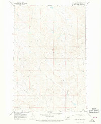
1965 Map of Darby Buttes SW
USGS Topo · Published 1968About this map
Wolf Springs serves as a rare watering point in this high-plains landscape of Garfield County, documented during the mid-1960s. The terrain is defined by a dense network of intermittent drainage systems, where seasonal water flow has carved distinct landforms such as Tinsley Coulee and Long Coulee. These features, along with the headwaters of Wolf Creek and Badger Creek, reflect the complex hydrology required to sustain ranching operations in this part of Montana. Scattered infrastructure includes several labeled Wells and two prominent Radio Towers, which stand as landmarks atop the higher elevations. The map captures the region's character as an open grazing territory where life centers on the intermittent reaches of Tepee Creek and the southern extent of Santo Arroyo.
Find a feature on this map
18 named features on this map. Tap any name to fly to it.
Don’t see what you’re looking for? This feature index may not catch every label — zoom into the map to look around manually.
Map Details
Editions of this 1965 Darby Buttes SW Map
This is the sole edition of this map. No revisions or reprints were ever made.
Other maps of this area

1954 · Jordan
USGS Topo · 1:250,000

1954 · Forsyth
USGS Topo · 1:250,000

1956 · Jordan
USGS Topo · 1:250,000

1957 · Forsyth
USGS Topo · 1:250,000

1958 · Jordan
USGS Topo · 1:250,000

1958 · Forsyth
USGS Topo · 1:250,000

1964 · Jordan
USGS Topo · 1:250,000

1965 · Kirby Ranch
USGS Topo · 1:24,000

1965 · Darby Buttes
USGS Topo · 1:24,000

1965 · Dice Dam
USGS Topo · 1:24,000