
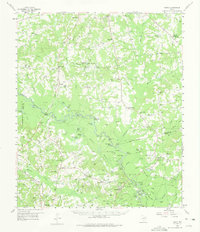
1958 Map of Darco
USGS Topo · Published 1960About this map
The Sabine River carves a winding path through this East Texas landscape, defining the boundaries between Harrison, Rusk, and Panola counties. In the late 1950s, this region was a complex mosaic of industrial activity and traditional rural life. The extractive economy is evident in the Carthage Gas Field to the south and the significant Darco Mine operations near the settlement of Darco. Local genealogy and social history are anchored by an extensive network of country schools and churches, including the Rosenwald Vocational and Agriculture Sch and Harris Chapel.
Find a feature on this map
108 named features on this map. Tap any name to fly to it.
Don’t see what you’re looking for? This feature index may not catch every label — zoom into the map to look around manually.
Map Details
Editions of this 1958 Darco Map
2 editions found
Other maps of this area

1943 · Waskom
USGS Topo · 1:62,500

1944 · Caddo Lake
USGS Topo · 1:62,500

1945 · Waskom
USGS Topo · 1:62,500

1945 · Socagee Bayou
USGS Topo · 1:62,500

1946 · Caddo Lake
USGS Topo · 1:62,500

1956 · Tyler
USGS Topo · 1:250,000

1956 · Deadwood
USGS Topo · 1:62,500

1958 · Carthage
USGS Topo · 1:62,500

1958 · Tatum
USGS Topo · 1:62,500

1960 · Minden
USGS Topo · 1:62,500