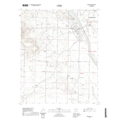
2020 Map of Dardanelle
USGS Topo · Published 2020About this map
Dardanelle and the southern edge of Russellville flank the Arkansas River at a historic crossing point where the Yell County - Dardanelle Courthouse stands as a focal point of local administration. The topography is defined by significant elevations like Dardanelle Mtn, Dardanelle Rock, and the eastern slopes of Mt Nebo, which overlook a network of watercourses including Smiley Bayou and Harris Cr.
Find a feature on this map
161 named features on this map. Tap any name to fly to it.
Don’t see what you’re looking for? This feature index may not catch every label — zoom into the map to look around manually.
Map Details
Editions of this 2020 Dardanelle Map
This is the sole edition of this map. No revisions or reprints were ever made.
Other maps of this area

1888 · Dardanelle #4
USGS Topo · 1:62,500

1888 · Dardanelle #2
USGS Topo · 1:62,500

1888 · Dardanelle #1
USGS Topo · 1:62,500

1888 · Dardanelle #3
USGS Topo · 1:62,500

1890 · Dardanelle
USGS Topo · 1:125,000

1956 · Russellville
USGS Topo · 1:250,000
1962 · Russellville East
USGS Topo · 1:24,000

1962 · Delaware
USGS Topo · 1:24,000
1963 · Russellville West
USGS Topo · 1:24,000

1964 · Russellville
USGS Topo · 1:250,000