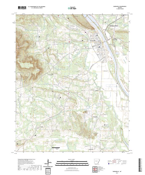
2024 Map of Dardanelle
USGS Topo · Published 2024About this map
The Arkansas River carves a sharp divide between Pope and Yell counties, anchoring the twin communities of Dardanelle and Russellville. This river-bend landscape is defined by its transition from the steep elevations of Dardanelle Mtn and Mt Nebo in the west to the alluvial plains of Elberta Bend. The map documents a dense network of family history markers, particularly through its numerous rural burial grounds such as Banks Hill Family Cem and the Thompson Family Cem near Prosperity.
Find a feature on this map
157 named features on this map. Tap any name to fly to it.
Don’t see what you’re looking for? This feature index may not catch every label — zoom into the map to look around manually.
Map Details
Editions of this 2024 Dardanelle Map
This is the sole edition of this map. No revisions or reprints were ever made.
Other maps of this area

1888 · Dardanelle #4
USGS Topo · 1:62,500

1888 · Dardanelle #2
USGS Topo · 1:62,500

1888 · Dardanelle #1
USGS Topo · 1:62,500

1888 · Dardanelle #3
USGS Topo · 1:62,500

1890 · Dardanelle
USGS Topo · 1:125,000

1956 · Russellville
USGS Topo · 1:250,000
1962 · Russellville East
USGS Topo · 1:24,000

1962 · Delaware
USGS Topo · 1:24,000
1963 · Russellville West
USGS Topo · 1:24,000

1964 · Russellville
USGS Topo · 1:250,000