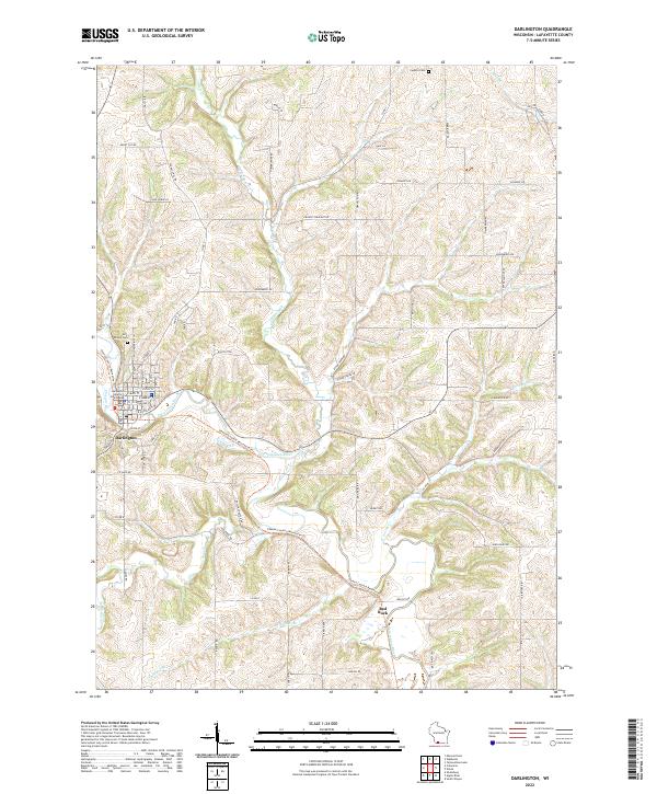
2022 Map of Darlington
USGS Topo · Published 2022About this map
The Lafayette County Courthouse serves as the focal point for Darlington, where a grid of streets meets the winding course of the Pecatonica River. This landscape is defined by the sharp dendritic drainage patterns of the Driftless Area, with tributaries like Otter Creek, Ames Branch, and Thunder Br carving deep into the terrain. Outside the main settlement, the smaller community of Red Rock and various family-named routes such as Parkinson Rd and Reichling Ln suggest a long-standing agricultural and rural network.
Find a feature on this map
73 named features on this map. Tap any name to fly to it.
Don’t see what you’re looking for? This feature index may not catch every label — zoom into the map to look around manually.
Map Details
Editions of this 2022 Darlington Map
This is the sole edition of this map. No revisions or reprints were ever made.
Other maps of this area

1902 · Mineral Point
USGS Topo · 1:125,000

1923 · Blanchardville
USGS Topo · 1:62,500

1923 · South Wayne
USGS Topo · 1:62,500

1952 · Shullsburg
USGS Topo · 1:24,000

1952 · Calamine
USGS Topo · 1:24,000

1952 · Mineral Point
USGS Topo · 1:24,000

1954 · Rockford
USGS Topo · 1:250,000

1955 · Rockford
USGS Topo · 1:250,000

1958 · Rockford
USGS Topo · 1:250,000

1959 · Dubuque
USGS Topo · 1:250,000