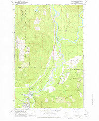
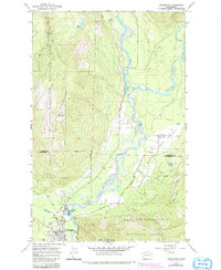
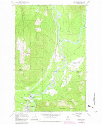
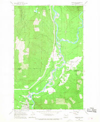
1966 Map of Darrington
USGS Topo · Published 1978About this map
The confluence of the Sauk River and the Suiattle River dominates this mid-1960s landscape, illustrating a region defined by timber and transit. In the southwestern corner, the town of Darrington serves as a hub where the Northern Pacific railroad terminates, supporting local industry represented by the Three Rivers Mill Pond. The terrain transitions from the broad alluvial floor of Sauk Prairie to the steep slopes of North Mountain, which is topped by a North Lookout Tower.
Find a feature on this map
30 named features on this map. Tap any name to fly to it.
Don’t see what you’re looking for? This feature index may not catch every label — zoom into the map to look around manually.
Map Details
Editions of this 1966 Darrington Map
4 editions found
Other maps of this area

1899 · Glacier Peak
USGS Topo · 1:125,000

1899 · Stillaguamish
USGS Topo · 1:125,000

1901 · Glacier Peak
USGS Topo · 1:125,000

1901 · Stilaguamish
USGS Topo · 1:125,000

1955 · Concrete
USGS Topo · 1:250,000
1957 · Silverton
USGS Topo · 1:62,500

1958 · Concrete
USGS Topo · 1:250,000

1962 · Concrete
USGS Topo · 1:250,000
1966 · Darrington
USGS Topo · 1:24,000
1966 · White Chuck Mtn.
USGS Topo · 1:24,000